
Baume les Messieurs - one of the most beautiful villages in France - is nestled in the depths of the Cirque de Baume - at the confluence of three exceptionally scenic valleys.
When it comes to altitude, the amazing cirque that surrounds Baume les Messieurs ain't Mount Everest ... but it's surely just as worthy for a place in hiking history as one of the best places to "take a hike" anywhere in the world. Happily acclaimed "one of the most beautiful villages in France" (and indeed the entire planet), Baume les Messieurs has been on our "to do" list ever since we spotted it in a Jura magazine a couple of years ago, so it was great to finally set aside a weekend to drive the 100 or so kilometres over to the western edge of the Jura from St George .... and go hiking around this magical valley. Baume les Messieurs is situated in eastern France - in the French department of Jura, in the region called Franche-Comté.
The Reculée de Baume les Messieurs, or Reculée de Baume as it is also called, is considered to be one of the best examples of a reculée - a glacial-era cirque - anywhere in the world. The steep-sided valley (the cirque) has been carved into shape over millions of years - as ice and water have gradually eaten-into, and eroded away, the 200 million-year-old limestone sediments of this ancient Jura landscape.
The walk around the perimeter of the cirque is only about nine or ten kilometres in length, and takes about three-and-a-half hours (or four - if you take as many stops along the way as we do). So we got started at about 10:45, after parking the car in the car-park behind the old (11th century) abbey, and set out from the old fountain at the main intersection in the middle of the village. The altitude in the town centre is approximately 300 metres asl.

The perfect starting point - the fountain in the centre of Baume les Messieurs.

Getting ready to head out of Baume les Messieurs.
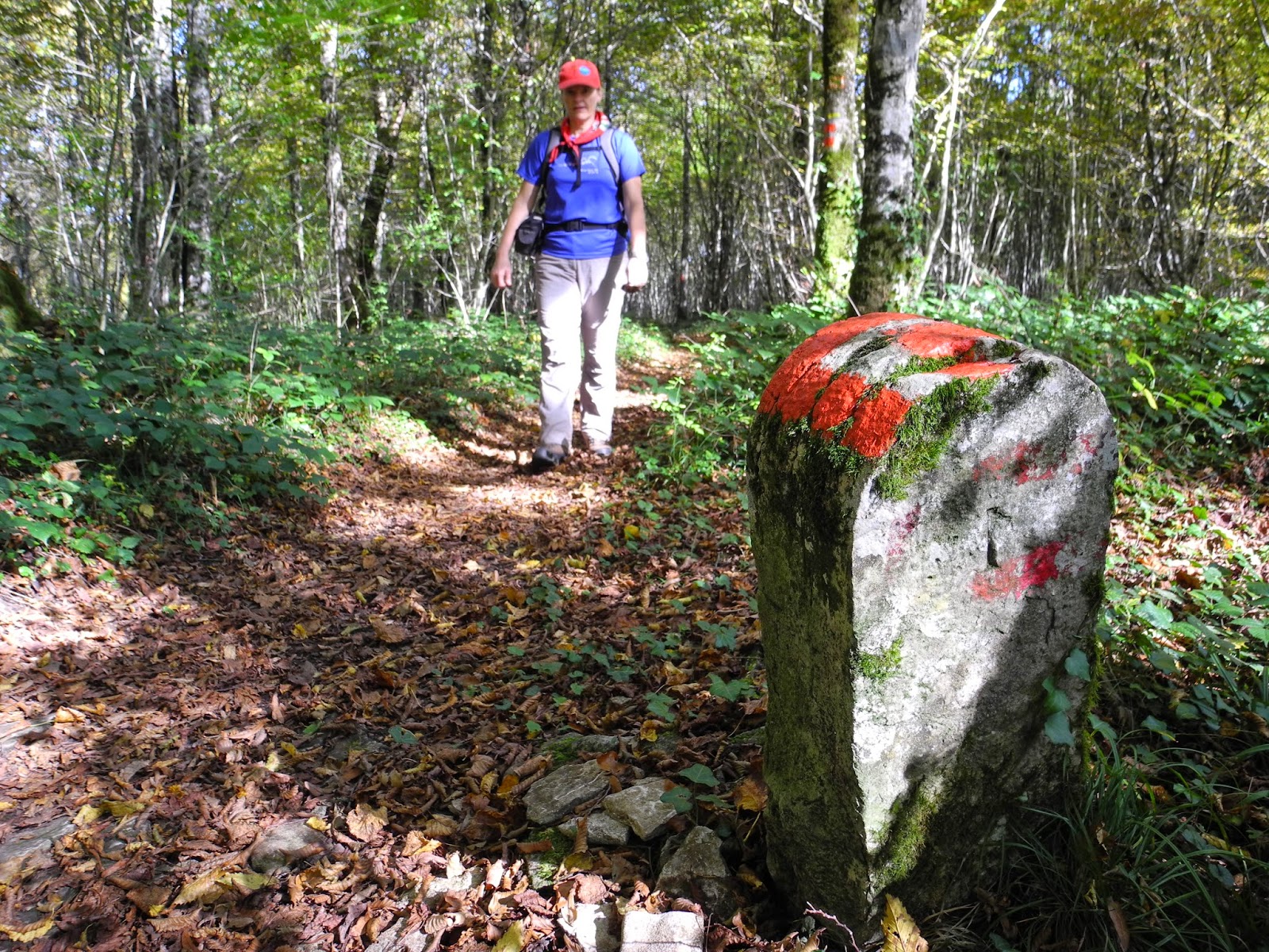
The first hundred metres of the walk was up the road just north of the Abbaye - along the Rue de Crancot - up the D70 towards the town of Crancot. At the first hairpin bend on the road there's a trail sign marked "Les laves" and "Abbaye" - at which point we left the road and followed a narrow dirt track that ran adjacent to a stone wall along that section of the village's northern boundary.

Leaving the road just above Baume les Messieurs.

Trail sign above l'Abbaye, at Baume les Messieurs.

The first section of the dirt track on the outskirts of Baume les Messieurs.
An occasional gap in the wall provided great views back over the village, up the valley, and across at the 200 metre high limestone cliffs all around the cirque. Needless to say, as we gradually gained altitude up the hillside above the town, we stopped whenever we could - to check-out the views, and take photos. There was no way that we were going to rush this walk. The place was already well and truly living up to its reputation for being "THE most beautiful".

Looking back over the town towards the top end of the cirque.

The stone wall on the outskirts of the village.
Eventually the stone walls gave way to cliffs and forest, and we were soon surrounded by steep rock-faces and drop-offs, and dense deciduous forests - including lots of lovely old oak trees. With autumn in full swing all around, the trail was frequently covered with lovely layers of leaf litter that had built-up on the forest floor - and which called on us to shuffle our boots along the ground and through the leaves like a couple of petites enfants. It was fun, and we were having the best time.

A gorgeous section of the shady trail up through the forest above the village.

Looking back down the hillside trail.
After a relatively steep hike up through the forest - which pretty much went from the floor of the valley to the top of the ridge that runs around the entire perimeter of the cirque - we emerged from the trees and found ourselves on the road between Baume les Messieurs and Crancot. The trail and the road coincided for about 100 metres - until a point marked "Vieux Mont" (at 495m) - from where it plunged back into the forest and swung westwards towards the Croix de Suchot.

Intersecting the "main" road just east of Baume les Messieurs.

The trail sign at Vieux Mont (495m).

Turn-off from the road at Vieux Mont.
Once again the forest track was just magical, with a beautiful shady canopy above us (perfect for the relatively warm weather conditions that we'd jagged), and a soft and crunchy layer of leaves on the forest floor beneath our feet. It was just perfect.

The lovely leaf-littered trail west of Vieux Mont.

Heading back into the forest between Vieux Mont and Croix du Suchot.
Now walking right alongside the eastern cliffs of the cirque, we got some wonderful views out over the valley - especially in the direction back towards Baume les Messieurs. Needless to say, whenever we could, we stopped to peer through the trees at the gorgeous views below us ... or to take a photo or two of the superb scenery: tall, stark, white limestone cliffs rimming the cirque; old stone-walled cottages in the village below; and fifty shades of autumn in the forests that spilled into the valley from the surrounding plateau. Typical of the latter, and the spectrum of autumn colours, was the section of the forest that we were passing through - the Bois de Suchot.

The view to the west - towards Baume les Messieurs.

Trail sign at Bois de Suchot (515m).
A few hundred metres after the Vieux Mont turn-off, we reached a trail sign marking the Bois de Suchot, and a corresponding fork in the road - with Belvédère des Roches off to the left, and Croix de Suchot to the right. We went to the right of course - as the Croix de Suchot is one of the highlights of this hike - and also marks the highest point of the trail that we were planning to cover - albeit a mere 510 metres. Apparently the highest point of the cirque is 538 metres, but we didn't have a topographic map, and weren't that fussed about finding the "summit". We were more interested on this occasion with having a great hike, and sticking to the regular route for the tour de la Cirque de Baume les Messieurs.

Taking the right fork in the forest - towards Croix de Suchot.

The beautiful forest track leading to the Croix de Suchot.
It didn't long to reach our next way-point - the Croix de Suchot - which (in our humble opinion) is the highlight of the entire walk. We stayed there for quite a while - walking around, and scrambling over the rocky outcrop under the imposing wooden cross to take-in the beautiful views that stretched-out before us. Down below in the valley we could see the entire brown-roofed village of Baume les Messieurs, while all around us, cliffs and forests and farmland stretched-out in all directions towards the horizon. We stayed there for quite a while ... and took lots of photos.

Trail sign at Croix de Suchot (510m).

The view towards Baume les Messieurs from Croix de Suchot.

Baume les Messieurs nestled in the Dard Valley below Croix de Suchot.

Panorama view of the cirque de Baume.

Checking-out the cirque from Croix de Suchot.

One of the most fabulous views of one of the most fabulous places
in the entire world.
in the entire world.
It was hard to tear ourselves away from the scenery at Croix de Suchot, but we eventually did, and then resumed our hike through the forest - initially back (east) to the turn-off at the Bois de Suchot, and then south towards Belvédère des Roches.

On the trail southeast of Croix de Suchot.

Section of the well marked trail southeast of Croix de Suchot.
The next milestone along the route, just over a kilometre from Croix de Suchot, was a place in the forest called St-Alderin - apparently named after a legendary old hermit who once inhabited these woods. With the trail passing over relatively even ground, being shaded, and mostly easy-going, we were soon there ... and gone again ... and looking to find a scenic spot where we could drop our packs and have lunch. By now, we'd taken a departure from the main track which heads towards Belvédère des Roches, and were instead following a lesser-used track that skirted the cliff-tops around towards the northwest.

The trail sign at St-Alderin (509m).
Following the red trail signs - old and new.

A view back up one of the valleys towards Baume les Messieurs.

On the trail through the leafy forest.

The view of Baume les Messieurs from our picnic site.

Taking-in the view from our amazing lunch-time picnic site.

Baume les Messieurs from our luncheon eerie.
After about half an hour, we once again shouldered our packs, and headed south towards the Belvédère des Roches ... once again on the same lovely, leaf-littered trail. It really was the most gorgeous track.

The trail through the forest heading towards Belvédère des Roches.

Lovely leaf litter on the forest floor.
Once again the trail broke-out of the forest - and onto a country road - at a place called Quartier sur Roches on the outskirts of the village of Crancot. From there it was just a short stroll down the road to the Belvédère des Roches - where there are a couple of cliff-top viewing platforms, and information panels, and a very strategically placed hotel (the Belvédère).

Turning onto the road at Quartier sur Roches.

Trail sign at Belvédère des Roches (507m).
We checked-out the vistas from the viewing platforms, and once again took lots (and lots) of photos. It was impossible to take just one photo, as there was something to see and capture in every direction. The view down the gorge from the head of the cirque is just beautiful.

View down the cirque from Belvédère des Roches (507m).

An old photo of the valley from one of the interpretation panels at Belvédère des Roches - showing a landscape almost completely denuded of trees many decades ago. This must have been at the height of the charcoal and wood fire era a century or so ago.

The panorama view down the cirque from Belvédère des Roches.
Once again, we tore ourselves away from the vista vantage-point and found the trail-head where the route wound its way from the top of the cirque to the valley floor - directly down the cliffs below. Fortunately it wasn't hard to find, with a sign saying "Grottes et cascades de Baume - par les échelles de Crancot 0.7km" marking the way.

Trail sign at the top of the cirque near Belvedere des Roches.
The track down from the top was steep and hugged the cliff-face. But it was also relatively easy-going - with concrete steps and steel hand rails making the passage relatively easy to negotiate in some of the steeper and more difficult sections. By all accounts, this part of the route - the "Echelles de Crancot" - can be very slippery if the rocks are wet. And, even dry, we had to take care whilst making our way down some of the steeper sections of the slope.

Heading down the steps and trail into the gorge below Belvédère des Roches.

Trail skirting the cliffs below Belvédère des Roches.

Under the cliffs at the top of the gorge.
At the top end of the gorge, down in the valley floor, there is a hotel/restaurant called "Le Belvédère des Roches", and a shop where day-trippers can buy tickets to visit the Baume caves - the Grottes de Baume. Being a lovely sunny Sunday, there were quite a few people in the valley, all obviously enjoying their day out in the country. We passed on the opportunity to visit and tour the caves - although I understand that they are quite spectacular, and well worth a visit. (Maybe the next time we're in this neck of the Jura). The cave is also the source of the Dard River - which emerges from the subterranean karst fissures and pours out onto the valley floor above a series of waterfalls - the largest of which is called la Cascade de Tufs. Apparently during peak flow - during the spring melt - the water surges out of the side of the mountain in a horizontal torrent, before crashing its way down over the waterfalls to the valley floor below. It is, by all accounts, quite a spectacle.

The cave entrance at the Grotte de Baume.

A section of la Cascade de Tufs.
We walked down past the upper waterfalls, across a small bridge over the river, and then down a series of steps towards Le Belvédère des Roches - passing, along the way, a sign marking the Grottes de Baume (375m) near a small cave at the foot of the heavily weathered, pock-marked cliffs.

Trail sign at Grottes de Baume (375m).

Looking down from La Cascade du Dard at Le Belvédère des Roches hotel.

The view down the gorge from La Cascade du Dard.

Le Belvédère des Roches hotel - nestled under the Cirque de Baume cliffs.
Rather than crossing the bridge over the Rivière du Dard to the hotel, we followed a track that ran alongside the western (left-hand) side of the river - and headed down the valley towards Baume les Messieurs. As had been the case all day, it was another lovely trail: shady, and soft underfoot, with the added bonus of a bubbling brook running right alongside.

The view down the Dard valley towards Baume les Messieurs.

The gorgeous track down the western side of the Dard River.
As one would expect, we stopped often to admire the views, to take photos and to ponder whether or not it was warm enough to take a plunge into the icy-green waters. There were some very inviting-looking pools.

One of the many magical waterfalls down the course of the Dard.

Checking-out the Dard's waterfalls.

The tranquil trail heading towards Baume les Messieurs.

Approaching a scree slope on the trail just south of Baume les Messieurs.
At about 15:30 we reached the outskirts of the village - at a place called Chapelle St-Roch - where the trail reached the edge of the forest and joined the road - the Rue des Moulins - that runs between Baume les Messieurs and the grotte at the top of the valley.

Trail sign on outskirts of Baume les Messieurs - at Chapelle St-Roch (310m).
The last part of the walk took us down through the streets towards the centre of the town, across an old bridge over the Seille River (into which the Dard had merged), and up to the car-park behind the Abbaye where we had parked the car about four hours earlier. Needless to say, we were in no rush to finish off this beautiful hike, so stopped for awhile at the bridge, listened to the water flowing past below us, and soaked-up the surrounding scenery and sunshine on that gorgeous sunny afternoon. This hike had been perfect - from start to finish.

Arriving on the outskirts of Baume les Messieurs.

At the bridge over the Seille River - in Baume les Messieurs.

The beautiful view down the Seille River.

At the end of the trail - at the Abbaye de Baume (305m).
Jura peaks bagged:
- Cirque de Baume (No 614) 510m
Trivia:
Jura wines: Not only is it one of "the most beautiful villages in France", but Baume les Messieurs is also a Jura wine jewel - being located in the heart of the Jura wine-growing region. The Jura vineyards - which produce some of France's most unique wines is divided-up into four sub-districts: Arbois, L'Etoile, Château Chalon, and Côtes du Jura - in which Baume les Messieurs is located.

Jura vineyards near Chateau Chalon.
The stony marl and limestone Jurassic terrain is ideal grape-growing country, and many of the hillsides throughout the region are blanketed with gold and green vineyards that produce a range of unique wines. Three red varieties are grown - Trousseau, Poulsard and Pinot Noir; but the region is better known for its whites - Chardonnay and Savagnin; and even more so for its "Vin Jaune", and other characteristic Jura wines Vin de Paille, Macvin du Jura, and the bubbly Crémant du Jura sparkling wine.

Vineyards of the Jura region.

Late afternoon colours over the Jura vineyards.
The Abbaye: In terms of architecture and heritage, the centre-piece of Baume les Messieurs is the ancient (11th century) benedictine abbey of Saint-Peter (which apparently occupies the site of an even older abbey that has its origins closer to when the town was first officially established - in 869). The original abbey was established by Saint Columbanus sometime in the late sixth century - taking advantage of a strategic location close to the old Roman road that connected Lyon and Besancon.
Richard, thanks for all these great posts. Quick question please: how did you find all those hikes? website? guides? others? I'd love to follow your steps, so to speak! thanks in advance
ReplyDeleteLots of research, as you say, from websites, guide-books, and scrutinising topographic maps. Enjoy the hikes. All fabulous.
Delete