Saturday March 31 was a gloriously sunny day in the Jura, meaning the last vestiges of snow still shining along the peaks and ridges would soon disappear. It cried-out for one last snowshoe expedition to another summit: the fifth-highest in the Jura: Le Colomby de Gex (sometimes incorrectly called "Le Colombier de Gex").

We left our trusty Subaru in the parking area on the side of the road near the first hairpin bend above Fontaine Napoleon (at 1175m), on the road heading-up to the Col de la Faucille from Gex, just over the border in France. This is a popular starting point for this walk - just near a small cluster of houses called Le Pailly. We shouldered our packs at about 10am, and immediately plunged into the forest on a narrow leaf-littered trail, feeling fresh and invigorated by the tangy forest odours, and the masses of bear's garlic bursting through the forest floor. Birds were singing everywhere. It was going to be a glorious day.
We soon intersected another trail - the Sentier de le Vie de Chaud - a steep track that took us upslope through the last of the forest and onto the rugged and rocky Jura escarpment above.

This proved to be more precarious, and more uncomfortable, than we would have liked - mainly due to a series of about eight avalanche flows that had streamed over the path. We gingerly climbed our way over each of them, cognizant that a Swiss snowshoer had been killed here by an avalanche in December 2008. Apparently he and his wife were heading-up le Vie de Chaud when an avalanche screamed down through the trees from the upper slopes of Petit Montrond above them. He was slammed into a tree and died instantly. His wife was seriously injured. You can imagine our relief when we eventually made it out of the danger zone and emerged from the forest. Immediately we were treated to a great view of Lac Léman and the Alps ... and three or four chamois scampering around the rocks nearby. It was the closest we had ever got to chamois in the wild.

As we got close to the top of the ridgeline we came across a sign saying the trail was a known avalanche area, and thus was closed between December 1 and April 15. Somehow we had missed seeing a similar sign (that I assume was at the bottom of the trail), but fortunately we were here now, so we pressed-on and over onto the "Balcon du Léman". There are a few places around the rim of the Jura ridgeline that are called the Balcon du Léman - places that provide a grandstand view of the lake and the arc of Alps on the other side.
Mont Blanc and all of the peaks were on fine display, above a layer of haze that hung over the lake and Geneva. We could even see the Matterhorn in the far distance.

We made our way over a series of crests and swales to Petit Montrond - 1534 metres and number 33 on our list of the highest summits in the Jura. The summit is dominated by a radio and TV broadcast aerial and transmitting station - which serves Geneva and much of French-speaking Switzerland. A popular location for skiers (there is a ski lift to the top from Mijoux - on the western, French side - and the Col de la Faucille), Petit Montrond also has a very grand-looking restaurant and dining balcony, which triggered a mental note to come back here sometime in high summer and enjoy a meal with one of the most spectacular panoramic views in the world. The place was deserted today, with everything shut-up - due to the ski season having finished, but the summer walking trails still covered with too much snow - and thus not yet popular. In a couple of months this place will be swarming with day-walkers, Jura Trail trekkers and other hikers and "pic-nickers".

We took a few commemorative photographs, then headed southwest along the Balcon du Léman ridgeline towards our next Jura peak - Montrond (1596m high, and number 18 on our list of Jura summits). Signs reminded us that we were walking in the Réserve Naturelle "Haute Chaine du Jura" where there are lots of things you can't do.

This area is apparently also riddled with deep karst holes which can be dangerous at this time of the year through being covered-over by snow, but fortunately we didn't encounter any of these. However, we did see lots of lovely purple and white crocuses, and the first leaves of millions of daffodils that are going to put-on quite an explosion of yellow in a couple of weeks when they're all in flower.

Other than that, the Jura crestline was decidely still post-winter, with patches of snow, sometimes still more than a metre deep, dominating the landscape, and sparse or stunted alpine vegetation.

We followed the ridgeline - often just metres away from the steep cliffs and escarpment on our left - that fell precipitously away to the valley floor 250 metres below. It was now about mid-day and, with the gloriously sunny conditions, we had fabulous views on both sides of us. We could see far into France on the western side.

We stopped briefly near the abandoned-for-winter farmhouse "Le Crozet" to pull on our snowshoes so we could climb the last, slippery, ice-and-snow-covered slope to the summit of Montrond. Montrond appears to be one of those multi-topped peaks, so we made our way up and down over two of them - one at at 1542m, then a second at 1544m - to the third (and highest), at 1596m. Montrond (or Mont Rond) literally means "Round Mountain" - being from Latin mons rotundus, and old French riond, reond.

We found a place out of the wind - just below the ridgeline and just above the cliff-face - where we pulled-on
our jackets and settled down to a fabulous lunch whilst gazing-out at the amazing view
provided by the lake and Alps. Lunch spots don't get much better than this!

Filled with hot tea, cheese, bread and fruit, we continued on our journey along the ridge, over two more un-named peaks - one at 1614m and another at 1606m - to the Pas de l'Echine - a small col at the foot of Colomby de Gex.


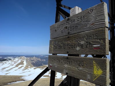
Once again, we pulled-on our snowshoes ... and slowly made our way-up our main destination for the day - the fifth-highest summit in the Jura - Colomby de Gex (1688m). First named in 1844, the summit gets its name from the town of Gex below, and the French word "colombe" or "colombier" which means a place where doves roost, i.e., in a high place. (Colomby in this case is derived from the Latin word for dove: columbus). Another hypothesis is that it is derived from the old French word colombe or Latin columen, columna - meaning a peak, a pinion or piller. Both options make good sense.

It didn't take us long to get to the top - where we took more commemorative pix and had a nip of Marc from my "hip flask emergency survival kit" to celebrate the occasion. A French hiker tuned-up while we were there and kindly offered to take a pic of the two of us at the summit.

Somewhere up here is meant to be a tomb of a famous Swiss aviator (Ferdinand Fluckiger) who crashed into the mountain, and died, on a foggy day in January 1932 (the 26th). Just days before, he had completed an historic flight around the rim of the Mediterranean, but on this day, close to home, he was caught-out by bad weather conditions while crossing the Jura and, in turning-back, misjudged the height of the mountain and crashed just below the summit of Colomby de Gex. He was killed instantly, and his body found two days later. I couldn't see the tomb anywhere, and assume that it was somewhere nearby, buried under the snow.
It was now about 2pm and we were at our furthermost point from where we had started our hike, so we commenced our return journey, dropped quickly below the ridge-top, and headed on a new route - southeast down the mountainside towards the "Plain du Pays de Gex".

We skirted around some precipitous cliffs and soon found ourselves on the shady side of a southward spur from the ridgeline, where we entered into some sugary-soft snowfields and forest leading up to, and beyond, the Chalet de Branveau.

The trail took us right past the foot of Montchanais (1446m and number 61 on our list), however we decided that it will just have to wait for another day - when we have a little more time and energy. It proved to be a good decision, as the next hour or so proved to be pretty "hairy" ... as we slipped and slid our way down the mountainside on a difficult-to-follow (and times, non-existent) trail. Masses of snow and, in a couple of places, avalanche debris obliterated any trail markers or tracks of previous walkers which might have marked the route.

Even so, whenever we were out in the open, we still enjoyed some magnificent views - with the Jura ridgeline now rising above us on our left, and the lake and Alps on our right ... although we were spending most of our time looking down, watching carefully where we were placing our feet.


At one stage, in the dense forest at the western end of Creux de l'Envers, the trail became faint ... and then completely disappeared, leaving us in a kind of "no mans land" on a steep and slippery slope covered with snow, mud and forest debris. We decided that going back was probably going to be just as hard as going forward - so we blazed a new trail straight down the mountainside alongside a bubbling river of meltwater - Le Torrent du Journans. As I expected, we eventually encountered the snow-covered track that led towards Chalet des Platières, a waypoint on our route "home". By now we were both completely exhausted, and our boots were sodden from tramping through thick snow, mud and meltwater. Our thoughts began turning to hot baths, dry clothes and room-temperature wine.
Conversation dried-up, along with our lips and parched mouths, and we stuck our heads down and tramped back towards Pailly. After passing by la Chalet de Platières (an old farmhouse which dates back to 1411) and La Quible, we eventually made it back to where we'd parked the car. It was now almost 5.30pm - seven and a half hours after we'd set-out that morning.
We were both tired, but it had been a great walk, with some of the most magnificent countryside and scenery we'd ever encountered ... and all right in our own backyard. You've got to love the Jura!
Jura peaks bagged:
Trivia:

We left our trusty Subaru in the parking area on the side of the road near the first hairpin bend above Fontaine Napoleon (at 1175m), on the road heading-up to the Col de la Faucille from Gex, just over the border in France. This is a popular starting point for this walk - just near a small cluster of houses called Le Pailly. We shouldered our packs at about 10am, and immediately plunged into the forest on a narrow leaf-littered trail, feeling fresh and invigorated by the tangy forest odours, and the masses of bear's garlic bursting through the forest floor. Birds were singing everywhere. It was going to be a glorious day.
We soon intersected another trail - the Sentier de le Vie de Chaud - a steep track that took us upslope through the last of the forest and onto the rugged and rocky Jura escarpment above.

Le Vie de Chaud.
This proved to be more precarious, and more uncomfortable, than we would have liked - mainly due to a series of about eight avalanche flows that had streamed over the path. We gingerly climbed our way over each of them, cognizant that a Swiss snowshoer had been killed here by an avalanche in December 2008. Apparently he and his wife were heading-up le Vie de Chaud when an avalanche screamed down through the trees from the upper slopes of Petit Montrond above them. He was slammed into a tree and died instantly. His wife was seriously injured. You can imagine our relief when we eventually made it out of the danger zone and emerged from the forest. Immediately we were treated to a great view of Lac Léman and the Alps ... and three or four chamois scampering around the rocks nearby. It was the closest we had ever got to chamois in the wild.

Oops, didn't see one of these on the way up.
As we got close to the top of the ridgeline we came across a sign saying the trail was a known avalanche area, and thus was closed between December 1 and April 15. Somehow we had missed seeing a similar sign (that I assume was at the bottom of the trail), but fortunately we were here now, so we pressed-on and over onto the "Balcon du Léman". There are a few places around the rim of the Jura ridgeline that are called the Balcon du Léman - places that provide a grandstand view of the lake and the arc of Alps on the other side.
Mont Blanc and all of the peaks were on fine display, above a layer of haze that hung over the lake and Geneva. We could even see the Matterhorn in the far distance.

View from the "Balcon du Léman".
We made our way over a series of crests and swales to Petit Montrond - 1534 metres and number 33 on our list of the highest summits in the Jura. The summit is dominated by a radio and TV broadcast aerial and transmitting station - which serves Geneva and much of French-speaking Switzerland. A popular location for skiers (there is a ski lift to the top from Mijoux - on the western, French side - and the Col de la Faucille), Petit Montrond also has a very grand-looking restaurant and dining balcony, which triggered a mental note to come back here sometime in high summer and enjoy a meal with one of the most spectacular panoramic views in the world. The place was deserted today, with everything shut-up - due to the ski season having finished, but the summer walking trails still covered with too much snow - and thus not yet popular. In a couple of months this place will be swarming with day-walkers, Jura Trail trekkers and other hikers and "pic-nickers".

The TV/radio tower and restaurant at Petit Montrond.
We took a few commemorative photographs, then headed southwest along the Balcon du Léman ridgeline towards our next Jura peak - Montrond (1596m high, and number 18 on our list of Jura summits). Signs reminded us that we were walking in the Réserve Naturelle "Haute Chaine du Jura" where there are lots of things you can't do.

I think the third symbol says "no vomiting" in the reserve after hard climbing.
This area is apparently also riddled with deep karst holes which can be dangerous at this time of the year through being covered-over by snow, but fortunately we didn't encounter any of these. However, we did see lots of lovely purple and white crocuses, and the first leaves of millions of daffodils that are going to put-on quite an explosion of yellow in a couple of weeks when they're all in flower.

Lis in a patch of crocuses.
Other than that, the Jura crestline was decidely still post-winter, with patches of snow, sometimes still more than a metre deep, dominating the landscape, and sparse or stunted alpine vegetation.
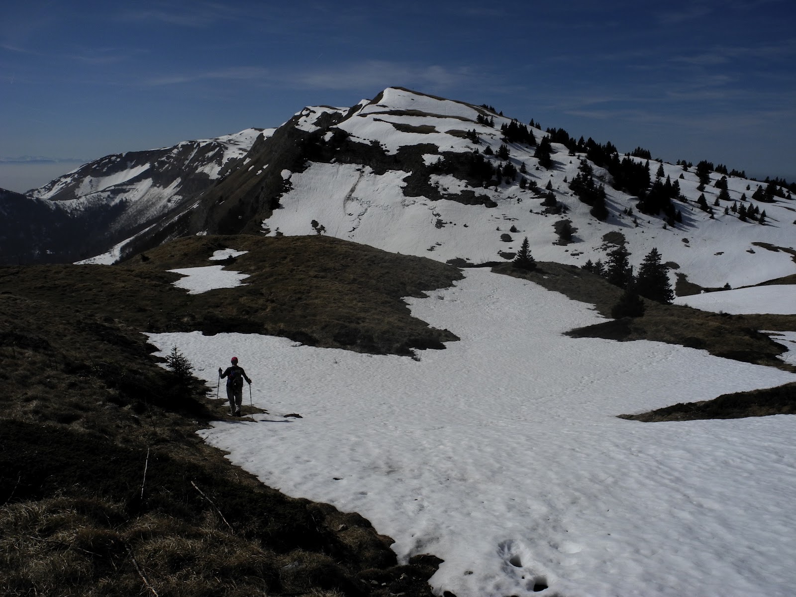
Lis heading south along the Jura Crest trail.

Le Crozat (1484m).
We stopped briefly near the abandoned-for-winter farmhouse "Le Crozet" to pull on our snowshoes so we could climb the last, slippery, ice-and-snow-covered slope to the summit of Montrond. Montrond appears to be one of those multi-topped peaks, so we made our way up and down over two of them - one at at 1542m, then a second at 1544m - to the third (and highest), at 1596m. Montrond (or Mont Rond) literally means "Round Mountain" - being from Latin mons rotundus, and old French riond, reond.

The view from Montrond - with Petit Montrond and La Dole in the background.

Looking back at the summit of Montrond (and Petit Montrond).
Filled with hot tea, cheese, bread and fruit, we continued on our journey along the ridge, over two more un-named peaks - one at 1614m and another at 1606m - to the Pas de l'Echine - a small col at the foot of Colomby de Gex.

The view back along the Jura ridgeline from le Pas de l'Echine.

Looking towards Mont Blanc and the Alps.
Once again, we pulled-on our snowshoes ... and slowly made our way-up our main destination for the day - the fifth-highest summit in the Jura - Colomby de Gex (1688m). First named in 1844, the summit gets its name from the town of Gex below, and the French word "colombe" or "colombier" which means a place where doves roost, i.e., in a high place. (Colomby in this case is derived from the Latin word for dove: columbus). Another hypothesis is that it is derived from the old French word colombe or Latin columen, columna - meaning a peak, a pinion or piller. Both options make good sense.

The last slope up to the top of Colomby de Gex.
It didn't take us long to get to the top - where we took more commemorative pix and had a nip of Marc from my "hip flask emergency survival kit" to celebrate the occasion. A French hiker tuned-up while we were there and kindly offered to take a pic of the two of us at the summit.

Near the small pylon at the top of Colomby de Gex.

Looking back at Montrond and Petit Montrond from Colomby de Gex.
Somewhere up here is meant to be a tomb of a famous Swiss aviator (Ferdinand Fluckiger) who crashed into the mountain, and died, on a foggy day in January 1932 (the 26th). Just days before, he had completed an historic flight around the rim of the Mediterranean, but on this day, close to home, he was caught-out by bad weather conditions while crossing the Jura and, in turning-back, misjudged the height of the mountain and crashed just below the summit of Colomby de Gex. He was killed instantly, and his body found two days later. I couldn't see the tomb anywhere, and assume that it was somewhere nearby, buried under the snow.
It was now about 2pm and we were at our furthermost point from where we had started our hike, so we commenced our return journey, dropped quickly below the ridge-top, and headed on a new route - southeast down the mountainside towards the "Plain du Pays de Gex".

Lis heading down the escarpment below Colomby de Gex.
We skirted around some precipitous cliffs and soon found ourselves on the shady side of a southward spur from the ridgeline, where we entered into some sugary-soft snowfields and forest leading up to, and beyond, the Chalet de Branveau.


Cutting our way across an avalanche flow.
Even so, whenever we were out in the open, we still enjoyed some magnificent views - with the Jura ridgeline now rising above us on our left, and the lake and Alps on our right ... although we were spending most of our time looking down, watching carefully where we were placing our feet.


At one stage, in the dense forest at the western end of Creux de l'Envers, the trail became faint ... and then completely disappeared, leaving us in a kind of "no mans land" on a steep and slippery slope covered with snow, mud and forest debris. We decided that going back was probably going to be just as hard as going forward - so we blazed a new trail straight down the mountainside alongside a bubbling river of meltwater - Le Torrent du Journans. As I expected, we eventually encountered the snow-covered track that led towards Chalet des Platières, a waypoint on our route "home". By now we were both completely exhausted, and our boots were sodden from tramping through thick snow, mud and meltwater. Our thoughts began turning to hot baths, dry clothes and room-temperature wine.
Conversation dried-up, along with our lips and parched mouths, and we stuck our heads down and tramped back towards Pailly. After passing by la Chalet de Platières (an old farmhouse which dates back to 1411) and La Quible, we eventually made it back to where we'd parked the car. It was now almost 5.30pm - seven and a half hours after we'd set-out that morning.
We were both tired, but it had been a great walk, with some of the most magnificent countryside and scenery we'd ever encountered ... and all right in our own backyard. You've got to love the Jura!
Jura peaks bagged:
- Colomby de Gex (No. 5) 1688m
- Montrond (No. 18) 1596m
- Petit Montrond (No. 33) 1534m
Trivia:
- Colomby de Gex is the 204th highest mountain in the Rhone Alps, and the 1,559th highest mountain in France (Peakery).
- Montrond is the 232nd highest mountain in the Rhone Alps, and the 1,643rd highest mountain in France.
- Petit Montrond is the 261st highest mountain in the Rhone Alps, and the 1,757th highest mountain in France.
No comments:
Post a Comment