
Crêt de Grison is a not much more than a small hill - at 1323 metres in altitude - hidden among the folds of the Jura Mountains about five kilometres northwest of the town of Bassins, in the Canton of Vaud, Switzerland. We've hiked, run and mountain-biked past it many times, but finally decided to make it the destination point for one of our Jura hikes. We added Crêt de Grison (as a side destination) to another designated trail in the vicinity - a NatuRando hike called "Le Sentier des Alpages", which we decided to start from a parking area on the side of the road between two homesteads (La Dunanche and Le Pessette) - but called La Pessette in the guidebooks.
We drove up there via Bassins, taking the Route des Montagnes road northwest out of town past Les Platets and through the forests of La Channelaz and Bois au Ministre - to a point marked 1128m on the topographic map. There, we left the car, checked-out all of the interpretation panels and, at about 13:00, set off on the well-signposted "Sentier des Alpages" trail.

Checking-out the information board.

The Sentier des Alpages (in green).
We parked at the red "I" spot at the bottom of the map.

The trail was well-marked with regular trail signs like this one.
We left the parking area by a side road that headed north along a track marked by a "Foret de l'Essert Chevalier" sign. The first part of the track was indeed through the forest, but then moved onto open alpine pasturage as we approached the first of the trail's featured alpages - La Pessette. We stopped just long enough at the old alpage homestead to take a couple of photos, and to read the interpretation panel, before rejoining the trail.

La Pessette alpage homestead.

Sketch of La Pessette .

La Pessette dates back to 1778.
The trail followed a farm track a little further up the hill, before re-entering the forest. The trees were a mixture of solid green conifers and all-shades-of-autumn deciduous trees - mostly beech. It was a glorious sunny afternoon, and the colours of the forest and lush brown layer of leaf litter on the trail made for a splendid ambiance.

Heading into the forest north of La Pessette.
The next alpage on the sentier was Le Crot, and we soon found ourselves approaching it - once again along a two-wheeled farm access road that cut across wide open pasturage. Once again we stopped to check-out the old house, to take a couple of photos, and to read the interpretation panel, before moving on.

Approaching Le Crot.

Le Crot homestead.

Sketch of Le Crot.

Old stone stock-yard at Le Crot.

An old mountain conifer at the northern end of the pasturage near Le Crot.
Once again the trail re-entered the forest. As it had been from the outset, it was well marked with "Sentier des Alpages" signs, as well as the regular diamond-shaped Swiss hiking trail signs, and regular splashes of yellow paint on suitable rocks and trees at strategic intervals and turning points along the way.

Swiss hiking trail sign.
About 300 metres into the forest north of Le Crot, we encountered the Transjurassien hiking trail - le Chemin de la Crêtes de Jura - at which point we turned right and headed up the steep slope to the east.

Trail sign where the Sentier des Alpages intersects La Grande Traversée trail
between Col du Marchairuz and Col de la Givrine.

Uphill track heading east along the GR5.
Approximately 150 metres along the track we stopped on a rocky outcrop to look back over the countryside below us - and Lac Leman and the arc of the Alps in the far distance. It sure was a magnificent sight, with a "Mer de Nuage" neatly blanketing much of the great lake. The Alps were in all of their glory - with their heads high above the clouds, especially Mont Blanc - the queen of them all.

Alps panorama - with the green Vaud landscape in the foreground.

Mont Blanc sits prominently above all of the surrounding Alp peaks.

Closer view of Mont Blanc.
(It's impossible to take too many photographs of this beautiful mountain.)
Although we could have stayed there for hours (it would have made a perfect picnic spot), we were soon back on the trail - which swung around to the north and left the forest as it approached the next alpage - Le Planet.

Heading up the trail just south of Le Planet.

Le Planet alpine homestead.

Sketch of Le Planet.

Interpretation board at Le Planet.

Trail sign at Le Planet.

Last glance at Le Planet before leaving the alpage.
At Le Planet, the Sentier des Alpages parted ways with the Chemin de la Crêtes du Jura (the GR5), and swung westward - down a well-formed forest road. The route was very easy-going, and most enjoyable. The road ran west for a couple of hundred metres, and then turned north - deeper into a forest called Bois de Peney.

Hiking along the forest road west of Le Planet.
At a point marked 1304 on the map - where four forest roads intersected - the Sentier des Alpages turned west, and then southwest, taking us back towards the Route des Montagnes - the road that we started on that connects Bassins with the Col du Marchairuz.

Trail intersection (at 1304) in the Bois de Peney.
Although we were still in the Bois de Peney forest we could see occasional reminders - such as the crumbling and now disused, ancient stone walls - that the livestock pasturage up here was once far more extensive than it is now, with a lot of the former cleared meadows and pastures having subsequently been reclaimed by the dense (yet regularly harvested) Jura forest. The region's modern, well-managed, sustainable and certified forest operations ensure that the landscape stays productive and permanent, meaning that sometimes it's hard to see at first whether some patches of forest have been harvested or not. This whole part of the Jura is designated the Parc Jura Vaudois - so the local foresters have to "get it right", so to speak.

Old crumbling stone wall in the Bois de Peney.
Our next way-point was an information panel and picnic area where the trail intersected the sealed Route des Montagnes. We stopped for awhile to read the signs, and then temporarily departed from the Sentier des Alpages trail to head a kilometre or so northwest towards the Crêt de Grison.

Picnic table and benches - at a point marked 1259 on the topographic map.

Information board detailing the zones of Parc Jura Vaudois - including the heavily-restricted District Franc Fédéral Le Noirmont (marked in green on the map) - a priority zone within the protected area.
Our way forward was now little much more than a stroll down a country road - but we didn't mind at all. We were having fun. We stayed with the road for about a kilometre-and-a-half - until we approached the lower slopes of Crêt de Grison - at which point we prepared to go cross-country to the summit. Up ahead of us we could see Crêt de Grison (on our right), and the peaks of Mont Pele and Mont Sâla in the middle distance - which we'd hiked to back in January 2013 (you can read about that hike here. That hike report also has more information about the access conditions for the Franc Fédéral Le Noirmont reserve. Important for hikers to know - especially with regards the restricted winter access conditions.)

Heading northwest along the Route des Montagnes near Crêt de Grison.

The summits of Mont Pele (1532) and Mont Sâla (1510).
A sign by the side of the road advised us that we'd arrived at a place called La Combe aux Corbeaux. This is significant, and good to know, because it more or less coincides with the start of a special protected area - an IUCN Category IV reserve called Crêt de Grison - which doesn't actually extend onto the slopes of Crêt de Grison, but encompasses a surrounding arc of dry grasslands of national significance. We quickly skipped over the grasslands, harming nary a leaf in the process, and began making our way up the side of Crêt de Grison.

Road sign at La Combe aux Corbeaux.

Heading up the lower slopes of Crêt de Grison.
After crossing a short section of alpine meadow, we entered the forest that covers the entire cap of the crêt. There was no regular trail to the top (this peak is not on anyone's list - except ours), so we had to make our way through the undergrowth and fallen branches, and up and over rocky outcrops and other small obstacles to the top. It didn't take us long to find the summit - 1323 metres - where we dropped our packs and wandered around to take in the scene and surrounding views - such as those that were afforded through gaps in the dense forest. Fortunately the summit was on the southeastern side of the hill - so once again we had great views of Mont Blanc and sections of the Alps.

The forest atop Crêt de Grison.

Standing at the summit of Crêt de Grison.

View of Mont Blanc from Crêt de Grison.
Crêt de Grison is interesting for a number of reasons, one being that it is a small island of Barrémien Cretacéous rock surrounded by a landscape of predominantly older Jurassic limestones. The Barrémien Oolitic limestone is derived from the youngest deposits in the Parc Jura Vaudois (laid-down some 113 to 117 million years ago), and are distinguished by their orangey-yellow colour and abundance of oolitic fossils embedded in the calcium-carbonate rock. We didn't see any fossils, and didn't stay at the summit for very long ... and were soon retracing our steps back down the hillside and onto the Route des Montagnes road. The view ahead of us - back towards Mont Blanc and the Alps - was absolutely fabulous.

Leaving the forest at the top of Crêt de Grison.

The view down the Route des Montagnes towards the distant Alps.
We retraced our steps back down the road to the picnic area (at the 1259 map reference - at which point we resumed our Sentier des Alpages trail), and then carried-on further south down the road towards our next waypoint. Along the way we passed turn-offs to the Fontaine des Rochers (on our left) and the Sapin Président des Rochers (on our right), however we didn't take either detour, being intent on pressing-on until we met the point where the Transjurassien walk trail intersected with the Route des Montagnes. Here, we turned right (to the southwest) and followed the Transjurassien route for as long as it coincided with the Sentier des Alpages route.

Signpost at Chemin de la Crêtes du Jura intersection.

Heading southwest into the forest from the Route des Montagnes.
The trail went first through forest, and then out into a narrow stretch of alpine pasture northeast of the Les Frasses homestead. Once again, it was easy-going, making for a most enjoyable hike.

The forest and pasture landscape near Les Frasses.
About three-quarters of a kilometre from the road we reached Les Frasses alpine homestead, which we quickly passed-by - as we did the main access road, which was completed flooded in sloppy black mud. Not totally unscathed, we reached the turn-off just southwest of the homestead - at which point we turned southeast and began heading back to where we'd parked the car at La Pessette.

Les Frasses homestead.

Sketch of Les Frasses.

Interpretation panel near Les Frasses.

Trail sign at an intersection just southwest of Les Frasses.
The last part of the Sentier des Alpages route was once again along a gentle, well-formed farm and forest access road, often with old dry stone walls providing a border on one or both sides. It was a lovely way to finish this hike, and we soaked-up the warm sunshine, and gorgeous views filled with golden autumn colours, and the distant backdrop of the blue, white and grey jagged Alps peaks.

Gentle stroll down the last section of the road near La Dunache alpage.
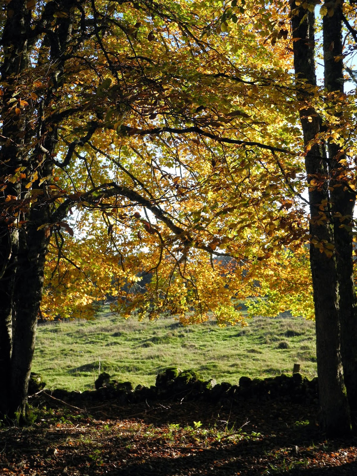
Autumn colours.

View towards the Alps over La Dunanche homestead.

Sketch of La Dunanche.

Informational board at La Dunanche. The building dates back to 1774.
At about 16:30, we arrived back at the parking area at La Pessette, where we dropped our packs in the car, took one last, long look at Mont Blanc and the Alps, and then headed (by car) back to our home in St George. The Sentier des Alpages is a great little hike, and Crêt de Grison a worthy diversion. It's a beautiful part of the Jura.

Back at La Pessette parking area.

Mont Blanc from La Pessette.
Jura peaks bagged:
- Crêt de Grison (No 129) 1323m
Trivia:
- The Sentier des Alpages is one of 34 hikes detailed in a handy guidebook that you can purchase from local bookstores, or you can find more details at www.naturando.ch or www.parcjuravaudois.ch
- The Crêt de Grison was our 70th Jura peak.
No comments:
Post a Comment