Le Reculet, the second highest peak in the Jura, has been calling me ever since I started this "Seven Summits" project at the start of the year. It's now late July, mid-summer, with the longest days of the year and lots of beautiful sunny weather. Surely this all adds up to another day's hiking in the Jura with nowhere better to go than to the top of le Reculet - number two on my list. Lis and I had been within easy reach of this summit just a couple of months ago (in May), when we climbed to the top of Crêt de la Neige (about a kilometre to the north), but had decided to "save" le Reculet for a dedicated hike of its own.
As we did for Crêt de la Neige, we drove from our home in St George to Geneva, then up to and through the little village of Thoiry. From there, we finished the motorized portion of our journey along a badly-weathered, pot-holed and crumbling, old bitumen road that ran through les Hauts de Thoiry to Tiocan, where (at 11.15) we left the car and commenced our latest Jura walking adventure. Tiocan, which only comprises a single restaurant/dwelling, is at 860 metres, which meant we had about 1,000 metres to gain in altitude and thus some steep climbing to do today (le Reculet is 1718m).

Tiocan's only building - the restaurant.
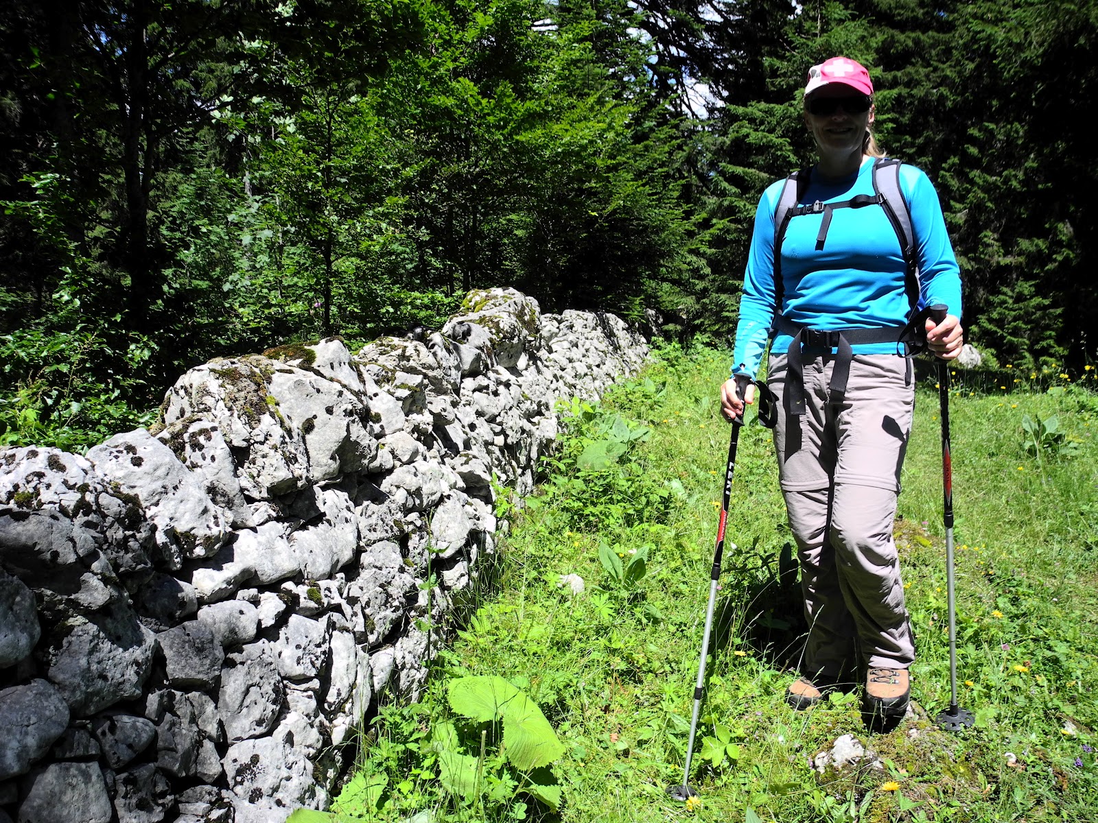
While we'd taken the steep, but shady forest trail (which starts just to the left of the restaurant) for our trek to Crêt de la Neige, this time we walked up the road to the right of the restaurant for about a hundred metres before turning left onto a dirt forestry road that zig-zagged its way up the mountainside.

Heading up the forest road towards the first breakaway.
After about half an hour of very steep walking we arrived at le Croisée, where there are two options for getting to le Reculet. We'd gone to the right last time, so this time decided to take the more rugged path to the left, via the Narderan refuge. (Strangely, it was labelled "Narderans" on the trail signs, and "Narderant" on our maps. Yet, at the refuge itself, which we reached about half an hour later, it has an old sign calling itself Narderan. I'm going with the sign on the refuge.)

Lis checking the map at le Croisée.
The trail from le Croisée up to Narderan was just lovely, with some good rugged scrambling at places and lots of ledges where one could stop and catch their breath and take in the amazing views over the plains of Geneva, the city and the mountains beyond. There was some cloud blocking-out parts of the Alps, but occasionally we got good views of Mont Blanc, which for much of the day was sporting a quiff of cloud blowing from its summit towards the north.

Heading up the trail between le Croisée and Narderan.

Trail stop near Narderan to take photos of Geneva and Alps.

Mont Blanc and its cloudy quiff.
We took a short break at the Narderan trail-sign (at 1330m) - to catch our breath and prepare for the second hour of slogging our way up the mountainside towards the summit.

Lis at the Narderan trail sign.
The next section of the trail was up the right hand side of the beautiful valley that encircles Narderan, with alpine meadows spreading across its floor up the bare rock cliff-faces that circled the valley. We stopped for awhile to watch a couple of chamois lazing in the shade at the foot of one of the cliff-faces, then headed-on up the steep and rocky path that wound its way through boulder fields towards a huge breakaway and its characteristic lower scree slope.

On the trail above Narderan.
The path eventually took us right under the cliffs, where once again we had magnificent views over the valley below us, and the plains of Geneva and the Alps beyond.

Lis looking down towards the Narderan refuge and Geneva.

Heading-up towards the ridgeline near le Reculet.
A few minutes later we crested the ridgeline, and got our first glimpse of le Reculet with its distinctive landmark iron cross at its summit. Fifteen minutes later (at about 1.30) we were sitting right alongside the crucifix, taking-in one of the best views either of us have ever seen. We dropped-down on some grass among the rocks and enjoyed our well-earned trail lunch, which we washed down with a couple of cups of nice hot tea.

Lis under the iron cross on le Reculet.
Le Reculet (1717.7 metres) is the second highest peak in the Jura. For many years it was thought to be the highest summit, until, as part of a re-survey by IGN France in 2003 and 2004, it was found to be just a couple of metres lower than its northerly neighbour Crêt de la Neige (1720.4m). (You can read all about that controversy on the Cret de la Neige blog - No 1.)

The summit of le Reculet with its distinctive iron cross.
The word "reculet" means a remote or isolated area, so the mountain name refers to it being a secluded, isolated mountain top, far from anywhere else. It's located in the Haute Chaine, the easternmost and highest chain of the French Jura. In the human landscape, it is situated in the Pays de Gex (Département de l'Ain), about 18 kilometres west northwest of Geneva.

Looking over the Valserine valley towards the western French Jura.
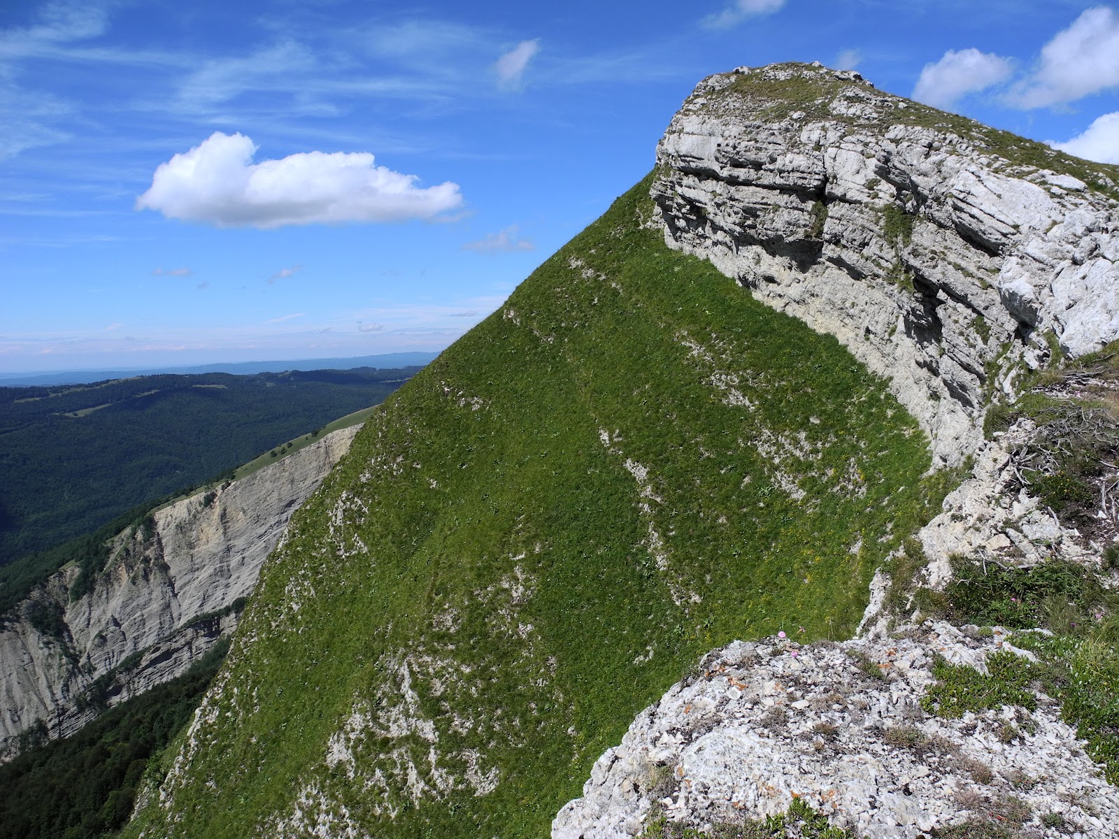
The views from the summit are brilliant. To the west, the ridgeline drops away sharply to the Pays des Gex and Geneva. To the west is the deep, dark and intriguing valley of Valserine and the smaller ridgelines of the French Jura diminishing and disappearing into the distance. To the north rules le Crêt de la Neige, while looking south reveals a string of peaks that stretch all the way to the Grand Crêt d'Eau and its beckoning five summits.

Looking north over the col of Sur Thoiry (1680m) towards Crêt de la Neige.

Looking south towards Roche Franche and Crêt de la Grotte,
and (in the far distance) Grand Crêt d'Eau.
If you're interested in the geology, according to our friends at Wikipedia:
"In terms of geological
structure it is an anticline of the Jura folds, where the rock layers at the
time of Jura folding in the late Miocene and Pliocene were pushed further west
on the underlying sediments. The anticline is broad at the root of some 5km and
is oriented in the strike direction of the Jura mountain chains in this section
in the direction SSW-NNE. The bedrock of the material comes from Reculet marine
sediments of the upper Jurassic period (in the combe area occur mainly
dolomitic limestones of the Port Landien, the limestone beds of Kimmeridgien
and Sequanien) and the Cretaceous (mainly at the foot of the slope)."

The anticline of le Reculet.
The other really interesting thing about le Reculet is its distinctive iron cross. This piece of art was forged/sculpted by a blacksmith from Thoiry, named Francois Nallet, and subsequently carried up to the summit on the backs of four men: Louis Girod, Aimé Fusier, Auguste Girod and Faustin Antonioli - in 1892. In 1992, on the 16oth anniversary of this amazing effort, a plaque was mounted on the side of the cross to commemorate their heroic mission, with a quote saying "History is a great present, and not just a past."

The plaque on the iron cross of Let Reculet.
I'm not sure which piece of history the quote is referring to: the Herculean effort
of the four bearers, or the battle between Catholicism and Protestantism
- for which the cross was built and erected. Apparently (or so the
story goes), the cross was built and brought up here by local Catholics
as a sign of defiance against Protestants and to strengthen
Catholicism in the Pays de Gex where the local population had for too many years been suffering from the religious wars which raged Europe in
the Middle Ages.

It's got me beat how four men carried this up the mountainside.
They must have been made of tough stuff.
Folks have been around here "forever", although one of the earliest records of settlement dates back to "just" 1340 - when the Count of Savoy granted land in the mountains above Thoiry for cattle pasturage. In 1410, a farmer named Narderan took-up the pastures of Thoiry, Thoiry Devant and Thoiry Derrière, with the latter two still functioning as established mountain farms - providing a base for summer pasturage.
We finished our lunch, then pulled-out our binoculars and watched chamois cavort in the pine trees below us. After sharing a celebratory nip of French brandy, we lay back in the sunshine and thought "life is good" kinda thoughts.

Feeling on top of the world at le Reculet.
At about 2.30pm, three hours after we'd left Tiocan, we re-shouldered our packs and got ready for the rest of our adventure - heading south along the Jura's highest ridgeline towards our next destination - Roche Franche (one of three peaks that I'd planned to knock-off today). We stopped for one last look at le Reculet, then hit the trail.

Our last close-up look at the summit of le Reculet.
Within half an hour, we were standing on the edge of the world, looking-out over a huge rock-strewn breakaway called Roche Franche. It gets its name from the Medieval Latin and Gallic word rocca, which (not surprisingly) means "rock".

Lis looking out over the Roche Franche breakaway.
This amazing gouge in the landscape lies to the west of the main ridgeline and, although where we were standing is not marked on the maps as such, it is known by many to be the summit of Roche Franche, which at 1692 metres, is the fourth highest point in the entire Jura. I pulled-out the Swiss flag (as I do) to commemorate the occasion, then took lots of photos in every direction, spell-bound by this amazing landscape.

Waving the flag at Roche Franche, with le Reculet in the background.

Lis looking out over Roche Franche and the Val de Valserine.

Looking southwest over the Val de Valserine towards the western Jura.

Looking south, with Crêt de la Grotte on the left and Grand Crêt d'Eau on the horizon.

Lis enjoying the views from the top of Roche Franche.

A final view from Roche Franche before heading
to Crêt de la Grotte (in the centre of this picture).
Although we could have spent hours enjoying the magnificent views from Roche Franche, time was getting on, and we still had a few K's to kill before our day was over. So we headed further south along the ridgeline towards Crêt de la Grotte, stopping only occasionally to admire the views and take photographs (of just about everything).

A bumblebee in pollen heaven on a thistle flower.
It didn't take long to reach the summit of our final peak for the day: la Crêt de la Grotte. We scrambled over the rocks and up a small cliff to the top, and once again were spellbound by the views. What a place! La Crêt de la Grotte is also called "la Grotte" or "la Marie du Jura". It's full name is actually "la Crêt de la Grotte de la Marie du Jura", and at 1644 metres, is the ninth highest peak in the entire mountain range. The name is derived from old Latin crestum, old French creste, and modern French crête, meaning crest, summit or ridge-top; grotte, meaning a cave, and Marie, from Mary - the Madonna, the virgin, the mother of Jesus - about whom much has been attributed.

Lis at the top of Crêt de la Grotte, with la Pierre de la Lune (1505m)
and Grand Crêt d'Eau in the background.

Looking back towards the summit of Roche Franche (top right).
Lis snapped the obligatory "Richard being silly at the summit" photo, then we scrambled back down the outcrop to check-out the "Grotte" after which this mountain-top was named.

Super-Rich on top of the Jura.
Most people who come up here never actually climb to the summit. They only come here to see the fabled cave below the cliffs called the "la Grotte de la Marie du Jura". It's about 100 metres further along the trail that we'd left to climb the summit - on the western side of the mountain crest. We carefully made our way along this skinny, at times precarious trail, with our eyes glued to the path. Once again, and only when we were able to stop and look up, the views were to die for (if you'll excuse the pun).

Lis on the trail below la Crêt de la Grotte summit cliff-face,
heading towards "la Grotte de la Marie du Jura".
The cave is only about three metres deep, wide and high, but is distinctive due a small statue of the Madonna, cemented into a cavity above a small cross at the back of the cave. Elsewhere around the walls is a scattering of candles and flowers left here by visitors. Apparently there is also a small plaque somewhere inside the cave commemorating the life of a small child who fell from the rocks nearby.

Outside the entrance to la Grotte de la Marie du Jura.

The statue of the virgin mother inside the cave.
There's an ancient inscription on a rock at the entrance which says that the cave was occupied by a hermit named "la Marie du Jura" in the early 13th century, hence its fame. Unfortunately the story of the hermit was a hoax - perpetrated by local farmers in the 18th century "to mock the church". We admired the view for awhile, then, with our mission accomplished (three of the highest 10 Jura summits bagged in one day), we started on our way back down the mountain.
Looking back at Crêt de la Grotte.
The cave is just at the foot of the cliff-face below the summit.

Our last view of the ridgeline, looking south towards la Pierre de la Lune (1505m).
Now if had been mid-winter, and we were on snow shoes, this would have been easy, as there is no direct trail back down the mountain from Crêt de la Grotte and we could have simply walked straight towards our next landmark - the mountain farm of la Chaz (la Chax on some maps). We could see it below us, but across some pretty rough and rugged rocky terrain. So we followed the ridgeline trail a little further to the south, before leaving it and heading east - cross-country along the contour - hoping to intersect a trail somewhere down below us that we could see marked on the map. It took a long time for the track to materialize, and even then it wasn't much of a track. Obviously, other than the local cattle and the occasional chamois (one of which we disturbed in the shade under a cliff face), not too many living creatures come along this way. We saw a mob of cows with some amazing horses at la Chaz, but that was about all. Certainly no other walkers.

La Chaz farmhouse.
Eventually we reached la Chaz, following which a little more cross-country "bush bashing" got us onto a more definite trail that dropped down below the treeline and led to the Narderan refuge. Boy, were we glad to reach there. By now, we'd been walking for about six hours, were low on water, and worn-out from our recent hilly and hummocky cross-country excursion.

Heading down towards Narderan.

Lis approaching the Narderan refuge (1337m).
We collapsed on the grass in the shade of the cabine, and re-fuelled with a sip of water and a handful of fruit and nut trail mix. I wandered around and took a few photographs, and then we headed-off down the mountainside towards Tiocan.

Plaque on the wall of Narderan recounting how the "Friends of the Mountain"
renovated the refuge in 1977.

One last look at the beautiful valley above Narderan.

Lis in a narrow gorge with the end - Tiocan
(and Thoiry, in the background) not far below us.
(and Thoiry, in the background) not far below us.
Less than an hour after leaving Narderan, we arrived back at Tiocan and a welcome stash of fresh water that we'd left in the car. It was about 6pm, almost seven hours after we'd set-out that morning. But, once again, it had been a great day's trekking in the Jura; with three peaks bagged, about seven hours blissfully consumed, about 16 kilometres walked, about a thousand "oohs" ahhed, and a million memories made. You've got to love the Jura. Cue smile.

Trail sign at Tiocan.
Jura peaks bagged:
- Le Reculet (No. 2) 1718m
- Roche Franche (No. 4) 1692m
- Crêt de la Grotte (No. 9) 1644m