Showing posts with label Jura Mountain hiking.. Show all posts

Thursday, March 13, 2014

La Cornette (No 47) & L'Egasse (No 56)


La Cornette and L'Egasse are two relatively little known peaks in the Jura Mountains, frequently bypassed by hikers looking to climb their higher, more prominent and more popular neighbour - Chasseral (ranked number 13 in the Jura - at 1607 metres). Despite being overshadowed by Chasseral, they're still legitimately on the list of the highest named Jura peaks - at number 47 and 56 respectively, so were there to be climbed one sunny day. And a sunny day it was on Sunday 9 March, 2014, when we set out to "bag" these two peaks.

Quite surprisingly, this is the first Jura summit hike that we've logged for 2014, mainly because we've been hiking elsewhere these past three months, have been traveling further afield, or have been restricted by the many weekends of less-than-favourable weather that typified the winter of 2013-14. If I'm going out to bag a Jura Mountain peak these days, the weather has got to be as ideal as possible. (Enough of the grey weather photos, I say).

And such was the case (i.e., sunny weather) last Sunday, when we drove about an hour and a half north of our home in St George, past Neuchâtel and Lac Neuchâtel, and back up into the Jura foothills to a small village called Nods (885m) from where we intended to start our hike. We drove straight through the town and found the road that headed-up to the Col du Chasseral, but stopped just on the outskirts of the village - in a car-park - from where we commenced our hike. We left the car-park at about 10:30am and, in glorious sunshine, began making our way up the forested slopes just north of the village.

Trail interpretation panel on outskirts of Nods.

With our snowshoes strapped to our backpacks, we "skipped" our way along the paved road that leads towards the Col - which is about five or six kilometres further up the mountain. But after just 500 metres along the road we came across a boom-gate that blocked further vehicular access - a regular winter seasonal closure due to the heavy mantle of snow that blanketed the upper slopes of the range at that time of the year.

The barrier gate on the road to the Col du Chasseral.

We negotiated our way around the gate, and then continued along the road atop the well-trampled-down snow. We were still in just our hiking boots. About a further 500 metres along the road, we crossed-over the main ski piste that comes down the mountainside from Hotel Chasseral to Nods, and soon after that turned right - onto a well-marked snowshoe trail (that followed the same route as the main summer walking trail up the mountain). It was a great trail, which led us through a beautiful patch of (predominantly spruce) forest. As one would expect, we were in high spirits as we began gaining altitude up towards the top of the main Jura ridgeline. We had about 600 metres of vertical altitude to gain to reach the crest, and about three kilometres of horizontal trail.

On the gorgeous snowshoe trail through the forest.

Sunlight filtering through the forest near Le Brulé.

For the most part, it was a relatively easy, gentle gradient, and well packed-down by previous walkers and snow-shoers. But after about a kilometre, we began to sink deeper into the snow and each step became progressively more difficult, so we stopped and pulled-on our snow shoes, after which we continued with much greater ease and assurance.

Heading-up through the forest near Les Cordonniers.

The snow shoes really became beneficial once we emerged from the forest again - at the upper tree line (at about 1400 metres) - where the snow was fresher, and deeper, and the gradient quite steep. Off to our right we got our first glimpses of the huge (120 metre high), red-and-white striped, communications tower that stands at the top of Chasseral (or Gestler - as the mountain used to be called under its German name) - which is the highest peak in the Bernese Jura. We'd first summited Chasseral back in September 2012 and, if you're interested, you can read the account of that hike here. Ahead of us, on the horizon, we could see our first destination for today - the semi-snow-covered Hotel Chasseral. I have a fondness for Chasseral for a number of reasons, one of which is that it was the setting for Hermann Hesse's famous 1907 short story "The Wolf". It's a sad tale, but well worth reading.

 Lis standing above a half-buried trail marker just below Chasseral.

 The distinctive "barber's pole" communications tower atop Chasseral. 
It was erected in 2010, on a site that has had a telecommunications station 
since June 1945.

The only landmark across the open ground (the "Paturage de Chasseral) below the Chasseral ridgeline was the half-buried (and completely closed) Métairie Neuf Chalet - which is marked Mét. de Nods on the topographic map. (A métairie is an alpine farmhouse / tavern, where the owners provide seasonal meals to travelers - including home-made cheese - usually served in a traditional fondue.)

Sign outside the Métairie Neuf Chalet (or Nods?).

We stopped just long enough to take a photo, then pushed-on up the last stage of the ascent to the Hotel Chasseral. Once this landscape thaws-out (in spring), it's possible to drive (or catch a bus) all the way up to the hotel, so it's a popular day-trip destination throughout the summer months. But now, with a healthy blanket of snow over the whole mountain-top, the only visitors are those who are prepared to walk, snowshoe or ski all the way to the top of the ridge.

Heading-up the last ascent towards the Hotel Chasseral.

We got there at about mid-day, about an hour-and-a-half after we'd left Nods, and immediately flopped-down on one of the huge rocks that lined the southern edge of the ridge. At 1548 metres, it marked an altitude gain of about 600 metres from where we'd left the car in Nods. It looked like an ideal spot to enjoy our lunch, so we dropped our packs, took out our food, and munched away while we gazed-out over the plateau towards the distant, hazy Alps.

Lunch-stop on the rocks near Hotel Chasseral. It was first built in 1880, although rebuilt in 1925 when the original was destroyed by fire.

Although blessed with beautiful sunny, and intensely blue, skies above us, the views back down the mountainside and across the plateau to the Alps was somewhat less-than-perfect - being mostly obscured by a cloudy haze that filled the wide chasm between the two mountain chains. Through the haze, we could only just see the near side of the Lac de Biene below us, and we couldn't make-out the city of Biel/Bienne at the northeastern end of the lake at all. Similarly, we couldn't see much of the Alps - other than a thin profile of just the tops of the very highest peaks. No matter, the views around us - of the Jura - were magnificent. We had a great 360 degree panorama - that included Chasseral (to the northeast) and Chasseral Ouest (to the southwest). As mentioned previously, we'd been up this way back in 2012 - when we "ticked-off" five peaks - Chasseral, Petit Chasseral, Chasseral Ouest, Les Roches and La Corne - all in a single day's hike.

Trail signage at Hotel Chasseral.

After lunch (standard trail fare of cheese and home-made chutney sandwiches, hot tea, and fruit ... we had to ignore the alluring smells emanating from the Hotel's kitchen and dining room), we wandered around the ridge to check-out the signage, the views, and our next destination way-point.

We are there (at the red dot) - Hotel Chasseral.

Off to our northeast was the summit of Chasseral (1607m) and, to the north, Petit Chasseral (1571m) and the main Jura ridgeline.

Checking-out the views from the top of the Chasseral ridgeline.

To the southwest, the ridge was dominated by Chasseral Ouest (1552m) and further afield, the peaks of the southern Jura.

Looking southwest with Chasseral Ouest at left, and our trail down in the foreground.

To the north, less than a kilometre away, lay the second Jura ridgeline, on which were the two peaks that we were intending to climb today - La Cornette and L'Egasse. Just to their right (to the east) was the valley and gorge of Combe Grède - which we fondly remember as being the scene of one of best walks we'd ever had in the Jura (en route to the top of Chasseral in September 2012).

Looking northwest - with our destination peaks - La Cornette and L'Egasse 
across the valley above the half-buried Métairie de St-Jean.

We stood there for quite awhile - watching paragliders fill their kites and leap-off the mountain-top before gliding their way over the range and down through the Combe Grède gorge towards St-Imier on the far side of the main ridgeline.
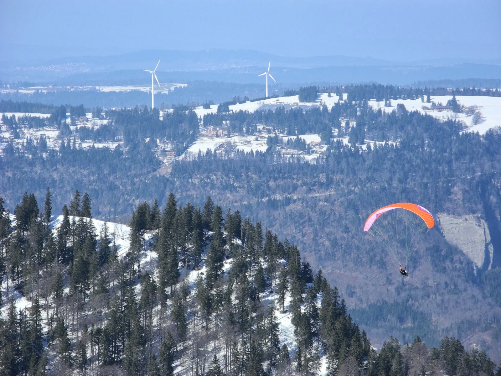
A paraglider passes L'Egasse on their way down through the Combe Grède.

Sometime around 1pm, we left the ridge-top in the vicinity of the hotel and headed down the steep slope on the northern side of the ridge - clinging precariously to the thin trail that snowshoers and skiers had carved into the heavily compacted snow. At times it was quite icy, and thus very slippery, so required a bit more attention than what we'd had to apply thus far on our walk. Of course, that also made it all the more exciting.

Heading down the north slope below Chasseral Ouest.

Once down in the valley floor (the lowest point of which is about 1389m), we cut a new trail due west across the snow, passing by the (winter-abandoned) Métairie de St-Jean and some signage reminding us that we were now deep in the Réserve Naturelle de la Combe Boisse (established in December 1976).

Trail sign reminding us that we were in the Réserve Naturelle de la Combe Boisse.

From there we headed up the next ridgeline - on a route that more or less followed the border-line between the Canton of Biel/Bienne (to the north) and Canton of Neuchâtel (to the south). Occasionally we were passed by skiers - mostly hardy-looking athletes geared-up for hard-core back-country adventuring. We were tortoises by comparison to their downhill plummets, but kept a similar pace going uphill.

Heading-up the slope towards the La Cornette ridgeline.

Once at the top of the ridge, in a small col, we stopped just long enough to catch our breath, and take a few photos of lichen-encrusted, weather-beaten reserve signs, then turned northeast along the ridge - towards the summit of La Cornette.

Ancient sign in the Reserve de la Combe Boisse. Hunting prohibited.

Looking northeast up the ridgeline of La Cornette.

Along the way we passed another protected area marker - this time for the Combe Grède Nature Reserve (1,202 hectares, established in May, 1932). This bright, new, blue sign stood atop a couple of very old, weather-beaten stone markers whose purpose I wasn't exactly sure. However they looked like they were marking a boundary of some sort, perhaps between the St Imier (or Villeret) and Nods communes, or something like that.

Reserve sign atop old stone markers - perhaps the border between
 the cantons of Bern (ahead) and Neuchatel (behind), or the communes of St Imier (or Villeret) and Nods.

It didn't take us long to reach the very top of the ridge - the summit of La Cornette (1494 metres) - which is actually a twin-peak mountain-top, with a mountain refuge hut nestled between them.

The mountain refuge at La Cornette.

Cornette means "rocky point, or peak", and comes from the Latin word cornua - which means a horn, or summit, or high point of land. La Cornette is in the commune of Villeret, in the district of Courtelary, canton of Bern/Bielle.

Sign above the door of the La Cornette hut: 1492m.

We dropped our backpacks and wandered around for awhile, before snapping-off the customary, ceremonial, flag-waving shot, and savouring the views from yet another Jura peak. It provided excellent views back over towards Chasseral and other smaller peaks of the main ridgeline.

Customary ceremonial flag waving shot at the summit of La Cornette.

Just to be sure, we took photos on both of the peaks, then took a swig of water and munched our way through a tasty fruit-and-nut bar.

More flag waving at the second La Cornette peak.

Our next destination - the top of L'Egasse - was only a few hundred metres away to the north. But first we had to drop down off La Cornette, cut across a small, barren col, and then follow the ridgeline further northeast to the summit. We carved a path down the steep, forested slope, through the deep powdery snow, and were soon out on the col. And, almost before we knew it, we were standing at the top of L'Egasse (1460 metres). This isn't much of a mountain by most Swiss standards, but it's got one of the best names. It's derived from the local name for the magpie.

Photo from the Chasseral ridge showing the proximity of L'Egasse (right) to La Cornette (left).

Once again, we snapped off a couple of photos to mark the occasion. Interestingly enough, L'Egasse is number 56 on the list of the highest named Jura peaks ... and was also the 57th Jura peak that we'd summited since we started our Jura Mountain Rambling project at the beginning of 2012. That's very cool.

Atop L'Egasse (1460 metres).

Being surrounded by trees, there's not much of a view from the summit (and not surprisingly there were no signs of anyone else having been up there), so we didn't stay long. Instead we retraced our steps back down the ridge - from where we got much better views - especially into the valley of St-Imier in the middle distance and the next Jura ridgeline and its army of wind turbines (19) that stood guard along the Franches Mountains ridge. Hidden from us, through the trees not far below, was the Métairie de l'Egasse - which is a popular refreshment point when it's open - between June and October every year (but not on Thursdays).

Looking northwest from L'Egasse with wind turbines on the horizon on the next Jura ridge and the Jura ridgelines fading away in the distance in France.

From L'Egasse we retraced our steps back to the small col, from where skirted around the eastern slopes of La Cornette on a steep traverse that took us back down into the Mét. de St-Jean valley. It was a slippery slope in places, which kept us "on our toes" so to speak.

Heading back down the mountain below La Cornette.

Along the way we had some great views down into the surrounding valleys and adjacent hilltops - so we frequently stopped to enjoy the scenery, and take photographs.

View to the northeast - up the valley west of Petit Chasseral (which is just out-of-sight on the right).

Having dropped right back down to the valley floor, we then headed back-up the opposite, steep slope below Chasseral and the top of the main ridgeline - which we'd left just an hour or two earlier. Once again, it was slippery going at times, but a lot of fun. Fortunately, neither of us took a tumble, however our legs were aching by the time we got back up to the top.

The last ascent - up the main Chasseral ridgeline again.

Looking back over the Métairie de St-Jean, with the Combe Grède gorge behind.

Once back on the ridge, we made a bee-line for the Hotel Chasseral, where we dropped our snowshoes at the door and headed inside for a drink and snack. We reckoned we'd deserved it.

Dropping the snowshoes outside Hotel Chasseral.

About half an hour later, we emerged from the hotel, pulled our snowshoes back on, and got ready to head back down the mountainside to Nods. But first we checked-out the big panorama interpretation table (the Panorama de Chasseral) - which identified all of the distant Alps' peaks that we should have been able to better make-out through the haze. The table has been there for quite some time - erected by members of the Chasseral branch of the Club Alpin Suisse (CAS).

The panorama interpretation table near Hotel Chasseral - 
and the distant Alps above the cloudy haze.

We could make-out quite a few of the peaks which jutted-out above the haze, whilst below us lay Nods ... and 600 metres of steep, knee-pounding descent. According to other accounts one can usually see (on a good day) "the Vosges, the Alsace Plain, part of Franche-Comte, the Black Forest, the Swiss and French Jura, and the Alps" - especially the majestic Eiger, Mönch and Jungfrau. We were not so lucky today.

The Alps in the distance, and our final destination - Nods - at the foot of the mountain.

Once again, we walked past the Métairie de Neuf Chalet (or Mét. de Nods), took one last, over-the-shoulder glance at the Chasseral communications tower, and then plunged back down into the forest in the area marked on the map as Les Cordonniers and Le Brulé.

Last glance back at le Chasseral near the Métairie de Nods.


We made good time heading downhill and, about an hour after we'd left the hotel, we were back in the car-park near Nods. It was about 4:30pm - six hours after we'd departed from there earlier in the day. Between the main ascent, then the ups-and-downs between the other summits and ridgelines, we figured we'd climbed about a thousand metres over the course of the day. Our legs felt like they'd had at least that (and more), but our souls were soaring. Life doesn't get much better than that.

The Jura Mountain ramblers.

Jura peaks bagged:
  • La Cornette (No 47) 1494m
  • L'Egasse (No 56) 1460m

Tuesday, January 8, 2013

Mont Pelé (No 34) and Mont Sâla (No 42)


Mont Pelé and Mont Sâla may not be on too many Jura hiker's lists of "Must-see-places-to-visit", but oh boy, are they missing-out on a couple of fabulous destinations! And if the journey really is better than the destination, then they're also missing-out on a great hike/trek/walk/ramble/snowshoe expedition as well. We hiked to both peaks on Sunday (the 6th of January, 2013), and had another competitor for "one of the best hikes of all time" in the Jura heartlands. Getting to Mont Pelé in particular, involved real back-country hiking - an authentic off-the-beaten-track, trail-cutting experience, which provided a great hike ... and some of the best views we'd ever experienced.

As for our previous two hikes, we set-out from the Col de la Givrine, where we parked the car in a small roadside car-park about a kilometre west of La Givrine. Driving out to La Givrine from St George early in the morning, we wondered what kind of a day was in store for us, as St George (940m), and everything below it, was blanketed in a thick layer of dense grey cloud. Fortunately, Ra (the sun god) was with us, and we drove-out of the foreboding, smothering cloud layer once we got to about 1100 metres. We were greeted by gorgeous sunshine by the time we reached St Cergue. Up at the Col, we hoisted our backpacks (at about 9.45am), speculated on the day's weather and the number of thousands of people who would fill this valley as the day wore on ... and then headed north up the trail.

The calm before the storm - the Col de la Givrine - before the arrival of the ubiquitous multitude of mid-winter day-trippers that come to enjoy this winter wonderland.

It was now a familiar path for us, having come this way on our last two hikes - to La Noirmont (No 24) and Crêt des Danses (No 32) - and we made record time through the Bois de la Givrine and past the half-buried (and, of course, winter-abandoned) Le Sollier farmhouse (1290m).

Le Sollier farmhouse (1290m).

Our next landmark was a big wooden sign telling us we'd once again entered the Parc Jurassien Vaudois protected area; followed soon by the (also winter-abandoned) Les Coppettes farmhouse/barn (1323m). Looming immediately beyond it were the twin peaks of Le Noirmont (1567m), but enticing as they looked - all covered in lovely white snow in blazing sunshine - they weren't our destination today.

 Les Coppettes (in the Valléé des Coppettes), with Le Noirmont in the background

We pushed-on - northeast up the Vallée des Coppettes - and into the Combe aux Tassons. After our two recent hikes up here, it was very familiar territory. I was keeping one eye on the trail and another on the sky: At times the "wide blue yonder" was filled with 30 or 40 jet-trails cutting all over the skies - as Sunday morning jet-setters skipped over the skies above us - heading for Paris, Rome, London and elsewhere around the world. As I feared, these trails (arguably lovely and picturesque in themselves), slowly flattened-out and merged into a thin blanket of diffuse stratus cloud, which dulled the sky as we watched.

Jet-trails in the southern sky over Les Coppettes and La Cure.

Thin stratus cloud forming-up from the higgledy-piggledy, criss-cross pattern of jet-trails.

Despite the "global dimming" going on 10,000 metres above us, the day was still glorious at ground level - the sun was shining, the snow was pristine, the going was easy and the landscape was adorable. And it appeared we had the entire Jura Mountains to ourselves. There wasn't another soul in sight.

A picturesque old dry-stone wall below Le Noirmont.

We stuck to a long thin depression right under the southwest slopes of Le Noirmont, and then Creux du Croue, and passed-by the empty and silent L'Arxière farmhouse which was hidden from our sight behind a small ridge.

Lis heading northwest into the Combe aux Tassons.

We climbed a small knoll to see if we could see L'Arxière, but couldn't, and then stayed there for a few minutes to look back down the valley - beyond which there were great views of the Jura peaks to the south, particularly La Dôle and, further south, Colomby de Gex.

Looking southwest - with Colomby de Gex, Montrond and Petit Montrond in the far distance.

About seven or eight kilometres to the south: le Pointe de Poele Chaud and La Dôle. 

The trek through the Combe aux Tassons turned-out to be a lot of fun. There were no existing tracks to follow, only the crazy twists and turns of one or two adventurous cross-country skiers who'd also ventured onto the "path less trodden". At times we plunged our way into deep drifts of snow, or semi-cascaded down steep slopes - in-and-out and up-and-down the multitude of hollows, hillocks, mounds and pits that characterized the landscape. Eventually we popped-out of our little snowshoe adventure playground, and back onto the main swale of the Combe aux Tassons.

Coming out of the topsy-turvy passage adjacent to Creux du Croue.

Leaving the ridges of Le Noirmont and Creux du Croue behind us, we soon reached the (winter-abandoned) La Croue farmhouse (1469m). It was now about mid-day. We stopped for awhile to catch our breath, have a drink of water and take a last look back at Creux du Croue before heading back into the forest.

Heading-up the slopes near La Croue.

Looking back from La Croue to the distant western cliffs of Creux du Croue.

La Croue farmhouse and the cliffs of Creux du Croue.

Soon after leaving La Croue we passed an information panel telling us we were now in the Swiss government's "District Franc Féderal du Noirmont" -  a priority zone within the protected area. We promised to be good and, as one of the two signs (roughly translated) advised: "Take nothing but photographs, leave nothing but footprints". We promised again (but see the footnote below).

Sign at the entrance of the District Franc Fédéral du Noirmont.

The trail then disappeared (with us along with it) into a patch of wild country called the Cimetière aux Bourguignons - the cemetery of the Burgundians. It was about the wildest section of back-country that Lis and I have experienced during all of our hikes in the Jura. The tortuous trail took us tumbling, turning and twisting over rocks and fallen logs; around pits and sinkholes; through mini gorges, and past cliffs and steep slopes. The "cemetery" moniker felt very fitting.

The rough-and-tumble terrain in the Cimetière aux Bourguignons.

This Tolkein-like, "Neanderthalic" landscape gets its name from the brutal 1476 massacre of Burgundian troops who, "on the tail" of their leader - Charles the Bold - were fleeing homeward following disastrous defeats by Swiss forces at, initially Grandson, and then (even more disastrously) at Murten (Morat) - in the lands east of Lac Neuchâtel. The invading, yet now defeated, Burgundians were pursued and harassed by Swiss mountain-hardened forces as they fled westward towards their homeland, only to meet their demise in the wild woods of the Jura Mountains. Following multiple, sporadic skirmishes on their route from Morat to the potential safety of Burgundy (if they could make it that far), they were finally, mortally ambushed in the triangular-shaped, wild "no-man's-land" between Creux du Croue, Mont Pelé and Mont Sâla ... and countless hundreds of hapless Burgundians lost their lives.

The conflict proved to be a critical turning point in what were called "the Burgundian Wars" - a long-running, on-and-off conflict between the Dukes of Burgundy and the Kings of France ... which occasionally also spilled-over into the Old Swiss Confederacy. One such "spill-over" occurred when open warfare between the "nations" broke-out in 1474, which resulted in Charles the Bold, the Duke of Burgundy, being defeated thrice on the battlefields and finally killed in the Battle of Nancy, in France, in 1477. Charles' dominion was a "narrow, yet incomplete band of land between France and the German Empire ... which he intended to expand into an uninterrupted territory stretching from the North Sea to the Alps". Hence his ambitions on the Jura.

As part of the thrust and parry of the Burgundian Wars, Swiss forces (who formed, with their allies from Alsace-Lorraine and the upper-Rhine/Habsburg, an "anti-Burgundian" league), conquered and claimed the Franche-Comté part of the Jura - following their victory at the Battle of Héricourt in November 1474. The Old Swiss Confederacy extended its dominion even further in the following year, when Bernese forces conquered Vaud, which at the time "belonged" to the Duchy of Savoy, an ally of Charles the Bold.

Charles retaliated against the Swiss Bernese in 1476, and marched his troops first to Grandson where, in the Battle of Grandson (on the 2nd of March 1476), he and his 20,000 troops were soundly defeated and forced to flee, abandoning their artillery, and a huge quantity of their provisions and valuable treasures. Charles regrouped his forces and, to avenge his Grandson defeat, attacked the Swiss forces again - at Murten (Morat) on the 22nd of June 1476. On this occasion, his forces were almost totally devastated in a humiliating lakeside battle, during which approximately half of his troops - some 10,000 men - were killed. Charles fled to the safety of a castle at Gex, while the remnants of his bedraggled and disorganized troops did their best to escape homeward, across the treacherous Jura Mountains. Unfortunately for some of them, they became lost, disoriented and hopeless, in the jumbled limestone landscape in the shadow of the three peaks (where Lis and I now stood) ... and were slaughtered by the pursuing Swiss forces. Today, the only reminder of this sad saga is a simple solitary cross which marks the place where hundreds, perhaps thousands, of souls perished while trying to escape a war they probably didn't even want to be in.

The simple and solitary monument in the Cimetière aux Bourguignons.

Probably unaware of this history, the pioneering English ice-caves explorer Reverend George Forrest Browne (from St Catherine's College, Cambridge) described the place in 1865 as:

"... a curious district on one of the summits of the Jura, where the French frontier takes the line of a crest, and the old stones marked with the fleur-de-lys and the Helvetic cross are still to be found. In these border regions the old historic distinctions are still remembered, and the frontier Vaudois called the neighbouring French Bourguignons, or, in their patois, Borgognons. They keep up the tradition of the old hatreds; and the strange, bleak summit, with its smooth slabs of Jura chalk lying level with the surface, is so much like a vast cemetery, that the wish in old times has been father to the thought, as they still call it the Cemetery of the Burgundians, Cimetiros ai Borgorgnons."

Knowing the full extent of the Cimetière's history, Lis and I paused for awhile at the stainless-steel cross, took a couple of photographs ... and then headed out of there. I kept glancing over my shoulder, among the trees and shadows, into the nooks and crannies, half-expecting to see the ghosts of the Burgundians following us from the shadows with their mournful, haunted eyes.

Feeling "touched" by the sombreness of the resting place of Charles the Bold's Burgundians.

Fortunately we made no such encounter, neither with ghosts of Burgundians, nor gollums, nor trolls; and after winding our way along a rather circuitous route, we "popped-out" in a small, open hollow called the Gouille-au-Cerf ("stag's puddle"?), just west of Mont Sâla. Off to our left we spotted the cabane at Creux Devant (1474m), so we wandered over there to take a photograph or two, then cut a zig-zag path up the adjacent, northwest slope of Mont Sâla.

The hut at Creux Devant (1474m)

We reached the summit of Mont Sâla (1511 metres) at about 12.45 - three hours of solid snow-shoeing after we'd commenced our walk - and were immediately rewarded for our travails. Off to the west was one of the most amazing sights that one can ever see from the peaks of the Jura - the full arc of the Alps floating above a layer, a sea of clouds - the "Mer de Nuages". The clouds completely obliterated Lac Léman, Geneva, Lausanne and all of the "lowland" Swiss Plateau below us. It was "gob-smacking". We stared, and stared, and took lots of photos; and then settled down on a majestic pedestal of rocks at the top of the cliffs, and ate our lunch while gazing at one of the most amazing sights we'd ever seen.

Appropriately, Mont Sâla gets its name from the word saillant which means a rocky promontory, or protruding height. (We were dangling our feet over the cliffs). It is derived from the Latin salire, salian - which means to "jump-out". There is also a local, regional word sallaz - which means rock, outcrop or talus slope.

Standing on top of the world - above the clouds - at Mont Sâla.

Looking south over la Mer du Nuages. Somewhere hidden under the grey blanket of cloud is the southern end of Lac Léman and the city of Geneva.

Looking east over la Mer du Nuage towards Mont Blanc.

Les Dents du Midi and adjacent Alps on the horizon above la Mer du Nuages.

Feeling blessed at another absolutely magical lunchtime picnic spot.

Once we'd finished lunch, topped-off with a customary, celebratory nip of French brandy, we took a few last, long looks at the scenery, along with another bunch of photographs, and then headed on our way. It was now about 1.30pm. The days are at their shortest at this time of the year, and we still had far to go.

Celebratory summit commemorative pic. From the top of Mont Sâla, it's actually possibly to see Crêt de la Neuve (where we found the Swiss flag during a hike there last year).

Checking-out the views, with Mont Tendre (in the far left distance) and Crêt de la Neuve (at right) on the horizon.

View of La Dôle and Colomby de Gex from Mont Sâla.

Looking southwest from Mont Sâla - with (the forested) Mont Pelé summit on the horizon, and an un-named, snow-covered, relatively bare, intermediate, 1515 metre peak in the middle distance.

We headed down the southwest side of Mont Sâla, cutting our own trail across the beautiful crunchy, untouched snow. Mont Sâla, with its clear summit and landmark cross, is obviously quite a popular destination for back-country hikers (as we had encountered quite a number of tracks on the way to the top). However our next destination - Mont Pelé - by no means enjoyed the same level of interest. In fact, once we left Mont Sâla, we didn't encounter another person's tracks for the next couple of hours.

Cutting a fresh trail down the southwestern slopes of Mont Sâla.

Like we'd encountered within the Cimetière aux Bourguignons, the country once again became a jumble of sinkholes, cliffs, gorges, logs, grottos and dead-ends. Regularly checking both our GPS and topographic map, we navigated our way on a tortuous, meandering route around the western side of the intermediate, un-named 1515 metre peak, and then scaled the northern side of Mont Pelé. Such was the difficulty of the terrain, and having to cut our own trail, that it took us about an hour and a quarter to travel just over a kilometre through the deep-snow, mountain maze.

Somewhat drained from the effort, we reached the top of Mont Pelé (1532 metres) at about 2.45pm and, knowing we still had a lot of country to cover before nightfall, didn't hang around for very long - which was a bit unfortunate really, because it was a beautiful, tranquil place, and once again the views (through the gaps in the trees) were "to die for". Ironically "Pelé" means a "mountain or land peeled, or naked" - which it certainly isn't. Maybe it was once, when it was first sighted, and named, but now it's mostly covered by forest). We took a few quick photographs, sighed deeply, then plunged once more into the deep-forest abyss - now on the southwest side of the mountain.

Planning the next steps at the summit of Mont Pelé.

Looking back from Mont Pelé - at Mont Sâla in the middle distance, and (15-20 kilometres further to the northeast) Mont Tendre on the horizon.

Looking over the Mer du Nuages above the southern end of Lac Léman - with the top of Mont Salève (the hills above Geneva) just breaking through (in front of the more distant Alps).

The view from Mont Pelé over the Mer du Nuages towards les Dents du Midi.

By now the thin layer of jet-catalyzed stratus cloud had all but dissipated, and we were treated to glorious blue skies above us. Also towering above us, were thousands of ancient conifers (the summit of Mont Pelé is almost completely covered in forest, with no ubiquitous cross ... which might explain its (lack of) popularity). Some of the old firs and spruce were dead, and their stark, sun-bleached trunks looked like bare, sun-baked skeletons in contrast to their living, verdant cousins and brethren all around. More stops. More photos.

Leaving only footprints down-slope from the summit of Mont Pelé.

Natural art installation - Jura style.

One disadvantage of leaving the regular trail is that it takes you a lot longer to get anywhere, and you increase your chances of getting lost in the backwoods. However this is far outweighed by the delight and excitement to be gained by forging your own trail; by cutting fresh tracks across untouched snow; by seeing no-one else; and by seeing things you won't see closer to "the madding crowd". Such was the case in the morass of hollows and mounds on the southwest slopes of Mont Pelé. All day we'd been encountering tracks and scats of deer, chamois, fox, hare and a multitude of smaller critters that I couldn't identify. Then suddenly we came across the distinctive tracks of the rare capercallie (Tetrao urogallus - the largest member of the grouse family). Apparently, in the Jura Mountains, the relict population of this isolated and critically endangered species, is estimated to now number only about 500 breeding adults. Fortunately we saw quite a few tracks, so that was a good sign.

Our excitement about seeing the capercaillie tracks more-or-less paled into insignificance, when soon after we came across the tracks of a lynx - it was the first time either of us had come this close to the fabled forest feline. Boy, were we excited. Eurasian lynx (Lynx lynx), which were eradicated from the Jura Mountains during the 18th and 19th centuries (after being widespread 500 years ago), were reintroduced (with four "official" specimens - two males and two females - from the Carpathian Mountains in Slovakia; and about another six "unofficial" individuals) in 1974-75. It appears another three individuals were unofficially released in Vaud in the late 1980s. It is estimated there are now about 70 or 80 individuals - which is virtually the maximum carrying capacity of the mountain chain. (A single lynx needs a large territory - between 70 and 250 square kilometres.)

 The tracks of the Eurasian lynx are very distinctive, having a relatively huge, rounded paw-print pattern, and a rear impression caused by fur between and behind the pads which give them a "snowshoe" effect when travelling across the snow in winter. Secretive, solitary animals, lynx prey primarily on chamois (Rupicapra rupicapra) and roe deer (Capreolus capreolus) (killing 50 or 60 of them a year), but also on brown hares (Lepus europaeus) and red fox (Vulpes vulpes), and occasionally on red deer (Cervus elaphus) and even wild boar (Sus scrofa). It was the over-hunting of these three species (by humans - 100-200 years ago) which primarily led to the disappearance of the lynx in the Jura (along with forest clearing - for timber, firewood and charcoal, the expansion of livestock grazing pastures in the mountains, and direct hunting of the lynx).

The tracks looked like they were a few days old, so we took a couple of photographs, then continued on our compass direction - which more or less coincided with the lynx's footprints for quite some time. Not surprisingly, we didn't see the lynx, but we did see a very healthy-looking red fox (Vulpes vulpes) nonchalantly trotting across the snowscape.

A lynx footprint in the snow near Mont Pelé.

Another footprint, showing the lynx's distinctive rear fur-pad "snowshoe" impression.

Our course took us just to the northwest of a place called Combe Gelée and, cresting a rise, we looked back and had a last glance of Mont Pelé shining in the warm afternoon sunlight. Down on the forest floor it wasn't so warm - probably about two or three degrees - and we kept-up a solid pace, still going cross-country in a south-westerly direction. For a short while we followed a snow-covered old dry-stone wall, which took us up and over the 1400 metre high Crêt au Bovairon, to a col east of L'Arxiere.

 Making our way through the forest near Combe Gelée.

Looking back at the forested peak of Mont Pelé.

Back in familiar territory for the first time for a few hours, we picked-up a trail that had been cut by other snow-shoers since the last snowfall, and headed over a ridge-top in the Bois du Carrox - just west of the Club Alpine Suisse Cabane du Carrox (1508m).

On the trail near the Cabane du Carrox.

A kilometre or so along the trail we broke-out onto the southern side of the ridge-top, right near a mountain house called "Grutli" (1425m), which (according to a sign above its front door), dates back to 1948. Avoiding a precipitous cliff-face just below the house, we picked our way around to the east, then zig-zagged down the slope through the forest. Once clear, we made a bee-line for the Le Sollier farmhouse - which we could see a kilometre or two ahead of us.

The all-quiet Grutli mountain house.

Coming out of the forested slope below Grutli.

We were now back in familiar territory (again), so soon passed Le Sollier and, as the sun dropped below the horizon in front of us, plunged back into the Bois de la Givrine. Although not much more than half a kilometre to pass through, the distance was plenty enough to separate day from dusk, and we found ourselves walking through, at first near darkness in the dense forest, and then twilight once we broke back out into the open at the Col del a Givrine. There was magic glow in the air, as the last soft light of the day lit-up the crest of La Dôle and the far-distant Alps. Adding to the scene, the little red train from La Cure shuffled its way across the valley as we headed down to the railway crossing where we'd parked the car. We got there at about 5.15pm - meaning we'd spent about seven hours on the trail today. What a day. And what a trek. Absolutely fantastic!

Emerging from the Bois de la Givrine.

The Col de la Givrine at dusk.

The summit of La Dôle catching the last rays of the setting sun.

Jura peaks bagged:
  • Mont Pelé (No. 34) 1532
  • Mont Sâla (No. 42) 1511
 Trivia:
  •  Prior to their reintroduction in the 1970s, the last evidence of lynx in the Jura was in 1830 - when one of the final survivors of the population was killed near Lignerolle, in Vaud, and another near Pontarlier, in neighbouring France.
  • The lynx reintroduced to the Jura included four "official" individuals: two at Creux du Van (Canton of Neuchâtel) in 1974 and another two in the same location in 1975; and nine "unofficial": two at Moutier (Canton of Bern) in 1972, four in the Vallée de Joux (Vaud) in 1974, and three near Jorat (Vaud) in 1989.
  • With regards the human assault on Switzerland's forests in the 19th century (that contributed to the demise of the lynx), the Russian writer Fyodor Dostoyevsky, who was living in Geneva at the time, wrote in 1868 that there was still enough forest left in the mountains, but because the mountain-dwelling Swiss "live like the savages", there "will be no forest left within 25 years".

Note about the District Franc Féderal du Noirmont
  • Hikers beware: In doing a bit of subsequent reading about the meaning of a place being designated a "District Franc Féderal" I discovered it includes a requirement that, in winter, all park visitors are requested to stay on the marked trails (although this isn't always the easiest thing to do when the landscape is covered in snow). It would have been really useful to have this information prominently displayed on the information panels near La Croue, and other entry points to the area. Obviously, had we known of this requirement at the time, we would have skipped going cross-country to Mont Pelé, and left it for a mid-summer hike. It's good to know. (You can find the full set of nine restrictions - including "no camping" and "dogs must be on a leash" - here.)