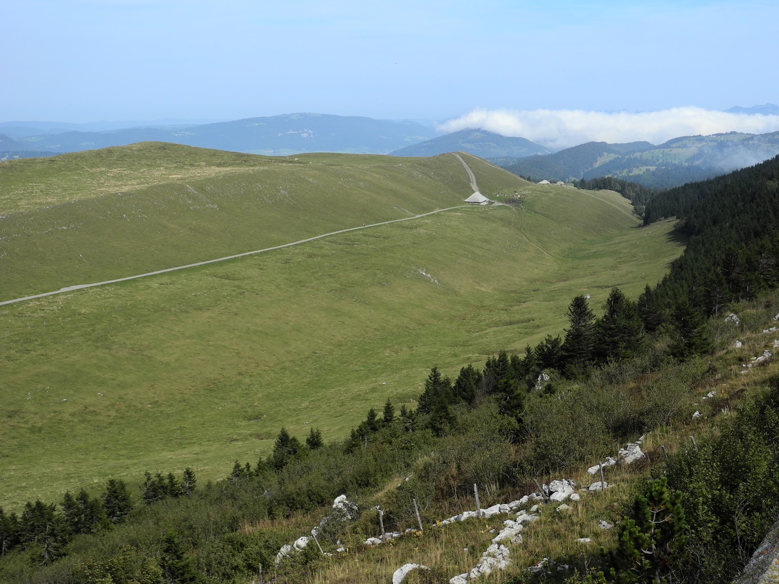
Showing posts with label Chasseral. Show all posts

Thursday, March 13, 2014

La Cornette (No 47) & L'Egasse (No 56)


La Cornette and L'Egasse are two relatively little known peaks in the Jura Mountains, frequently bypassed by hikers looking to climb their higher, more prominent and more popular neighbour - Chasseral (ranked number 13 in the Jura - at 1607 metres). Despite being overshadowed by Chasseral, they're still legitimately on the list of the highest named Jura peaks - at number 47 and 56 respectively, so were there to be climbed one sunny day. And a sunny day it was on Sunday 9 March, 2014, when we set out to "bag" these two peaks.

Quite surprisingly, this is the first Jura summit hike that we've logged for 2014, mainly because we've been hiking elsewhere these past three months, have been traveling further afield, or have been restricted by the many weekends of less-than-favourable weather that typified the winter of 2013-14. If I'm going out to bag a Jura Mountain peak these days, the weather has got to be as ideal as possible. (Enough of the grey weather photos, I say).

And such was the case (i.e., sunny weather) last Sunday, when we drove about an hour and a half north of our home in St George, past Neuchâtel and Lac Neuchâtel, and back up into the Jura foothills to a small village called Nods (885m) from where we intended to start our hike. We drove straight through the town and found the road that headed-up to the Col du Chasseral, but stopped just on the outskirts of the village - in a car-park - from where we commenced our hike. We left the car-park at about 10:30am and, in glorious sunshine, began making our way up the forested slopes just north of the village.

Trail interpretation panel on outskirts of Nods.

With our snowshoes strapped to our backpacks, we "skipped" our way along the paved road that leads towards the Col - which is about five or six kilometres further up the mountain. But after just 500 metres along the road we came across a boom-gate that blocked further vehicular access - a regular winter seasonal closure due to the heavy mantle of snow that blanketed the upper slopes of the range at that time of the year.

The barrier gate on the road to the Col du Chasseral.

We negotiated our way around the gate, and then continued along the road atop the well-trampled-down snow. We were still in just our hiking boots. About a further 500 metres along the road, we crossed-over the main ski piste that comes down the mountainside from Hotel Chasseral to Nods, and soon after that turned right - onto a well-marked snowshoe trail (that followed the same route as the main summer walking trail up the mountain). It was a great trail, which led us through a beautiful patch of (predominantly spruce) forest. As one would expect, we were in high spirits as we began gaining altitude up towards the top of the main Jura ridgeline. We had about 600 metres of vertical altitude to gain to reach the crest, and about three kilometres of horizontal trail.

On the gorgeous snowshoe trail through the forest.

Sunlight filtering through the forest near Le Brulé.

For the most part, it was a relatively easy, gentle gradient, and well packed-down by previous walkers and snow-shoers. But after about a kilometre, we began to sink deeper into the snow and each step became progressively more difficult, so we stopped and pulled-on our snow shoes, after which we continued with much greater ease and assurance.

Heading-up through the forest near Les Cordonniers.

The snow shoes really became beneficial once we emerged from the forest again - at the upper tree line (at about 1400 metres) - where the snow was fresher, and deeper, and the gradient quite steep. Off to our right we got our first glimpses of the huge (120 metre high), red-and-white striped, communications tower that stands at the top of Chasseral (or Gestler - as the mountain used to be called under its German name) - which is the highest peak in the Bernese Jura. We'd first summited Chasseral back in September 2012 and, if you're interested, you can read the account of that hike here. Ahead of us, on the horizon, we could see our first destination for today - the semi-snow-covered Hotel Chasseral. I have a fondness for Chasseral for a number of reasons, one of which is that it was the setting for Hermann Hesse's famous 1907 short story "The Wolf". It's a sad tale, but well worth reading.

 Lis standing above a half-buried trail marker just below Chasseral.

 The distinctive "barber's pole" communications tower atop Chasseral. 
It was erected in 2010, on a site that has had a telecommunications station 
since June 1945.

The only landmark across the open ground (the "Paturage de Chasseral) below the Chasseral ridgeline was the half-buried (and completely closed) Métairie Neuf Chalet - which is marked Mét. de Nods on the topographic map. (A métairie is an alpine farmhouse / tavern, where the owners provide seasonal meals to travelers - including home-made cheese - usually served in a traditional fondue.)

Sign outside the Métairie Neuf Chalet (or Nods?).

We stopped just long enough to take a photo, then pushed-on up the last stage of the ascent to the Hotel Chasseral. Once this landscape thaws-out (in spring), it's possible to drive (or catch a bus) all the way up to the hotel, so it's a popular day-trip destination throughout the summer months. But now, with a healthy blanket of snow over the whole mountain-top, the only visitors are those who are prepared to walk, snowshoe or ski all the way to the top of the ridge.

Heading-up the last ascent towards the Hotel Chasseral.

We got there at about mid-day, about an hour-and-a-half after we'd left Nods, and immediately flopped-down on one of the huge rocks that lined the southern edge of the ridge. At 1548 metres, it marked an altitude gain of about 600 metres from where we'd left the car in Nods. It looked like an ideal spot to enjoy our lunch, so we dropped our packs, took out our food, and munched away while we gazed-out over the plateau towards the distant, hazy Alps.

Lunch-stop on the rocks near Hotel Chasseral. It was first built in 1880, although rebuilt in 1925 when the original was destroyed by fire.

Although blessed with beautiful sunny, and intensely blue, skies above us, the views back down the mountainside and across the plateau to the Alps was somewhat less-than-perfect - being mostly obscured by a cloudy haze that filled the wide chasm between the two mountain chains. Through the haze, we could only just see the near side of the Lac de Biene below us, and we couldn't make-out the city of Biel/Bienne at the northeastern end of the lake at all. Similarly, we couldn't see much of the Alps - other than a thin profile of just the tops of the very highest peaks. No matter, the views around us - of the Jura - were magnificent. We had a great 360 degree panorama - that included Chasseral (to the northeast) and Chasseral Ouest (to the southwest). As mentioned previously, we'd been up this way back in 2012 - when we "ticked-off" five peaks - Chasseral, Petit Chasseral, Chasseral Ouest, Les Roches and La Corne - all in a single day's hike.

Trail signage at Hotel Chasseral.

After lunch (standard trail fare of cheese and home-made chutney sandwiches, hot tea, and fruit ... we had to ignore the alluring smells emanating from the Hotel's kitchen and dining room), we wandered around the ridge to check-out the signage, the views, and our next destination way-point.

We are there (at the red dot) - Hotel Chasseral.

Off to our northeast was the summit of Chasseral (1607m) and, to the north, Petit Chasseral (1571m) and the main Jura ridgeline.

Checking-out the views from the top of the Chasseral ridgeline.

To the southwest, the ridge was dominated by Chasseral Ouest (1552m) and further afield, the peaks of the southern Jura.

Looking southwest with Chasseral Ouest at left, and our trail down in the foreground.

To the north, less than a kilometre away, lay the second Jura ridgeline, on which were the two peaks that we were intending to climb today - La Cornette and L'Egasse. Just to their right (to the east) was the valley and gorge of Combe Grède - which we fondly remember as being the scene of one of best walks we'd ever had in the Jura (en route to the top of Chasseral in September 2012).

Looking northwest - with our destination peaks - La Cornette and L'Egasse 
across the valley above the half-buried Métairie de St-Jean.

We stood there for quite awhile - watching paragliders fill their kites and leap-off the mountain-top before gliding their way over the range and down through the Combe Grède gorge towards St-Imier on the far side of the main ridgeline.
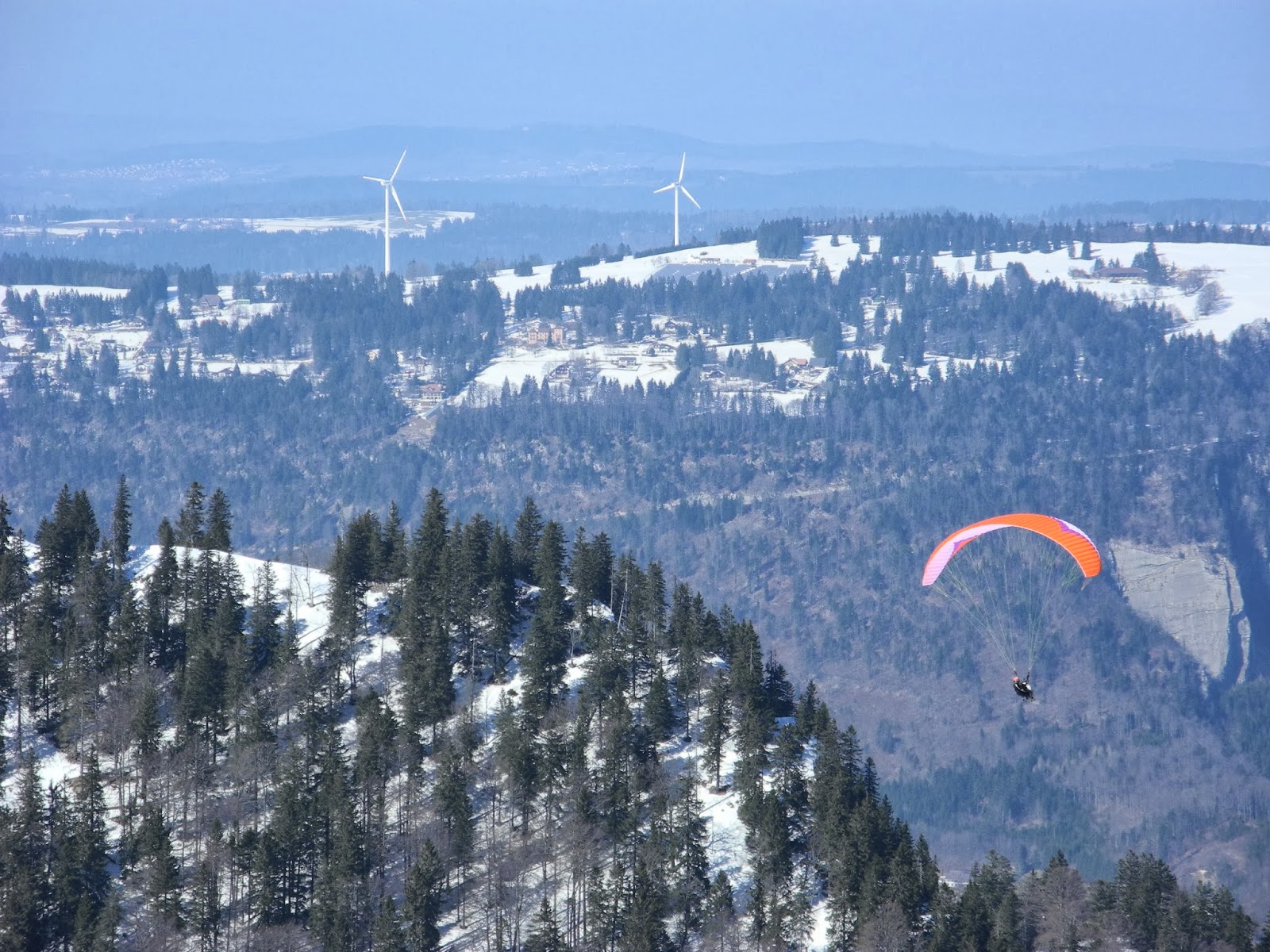
A paraglider passes L'Egasse on their way down through the Combe Grède.

Sometime around 1pm, we left the ridge-top in the vicinity of the hotel and headed down the steep slope on the northern side of the ridge - clinging precariously to the thin trail that snowshoers and skiers had carved into the heavily compacted snow. At times it was quite icy, and thus very slippery, so required a bit more attention than what we'd had to apply thus far on our walk. Of course, that also made it all the more exciting.

Heading down the north slope below Chasseral Ouest.

Once down in the valley floor (the lowest point of which is about 1389m), we cut a new trail due west across the snow, passing by the (winter-abandoned) Métairie de St-Jean and some signage reminding us that we were now deep in the Réserve Naturelle de la Combe Boisse (established in December 1976).

Trail sign reminding us that we were in the Réserve Naturelle de la Combe Boisse.

From there we headed up the next ridgeline - on a route that more or less followed the border-line between the Canton of Biel/Bienne (to the north) and Canton of Neuchâtel (to the south). Occasionally we were passed by skiers - mostly hardy-looking athletes geared-up for hard-core back-country adventuring. We were tortoises by comparison to their downhill plummets, but kept a similar pace going uphill.

Heading-up the slope towards the La Cornette ridgeline.

Once at the top of the ridge, in a small col, we stopped just long enough to catch our breath, and take a few photos of lichen-encrusted, weather-beaten reserve signs, then turned northeast along the ridge - towards the summit of La Cornette.

Ancient sign in the Reserve de la Combe Boisse. Hunting prohibited.

Looking northeast up the ridgeline of La Cornette.

Along the way we passed another protected area marker - this time for the Combe Grède Nature Reserve (1,202 hectares, established in May, 1932). This bright, new, blue sign stood atop a couple of very old, weather-beaten stone markers whose purpose I wasn't exactly sure. However they looked like they were marking a boundary of some sort, perhaps between the St Imier (or Villeret) and Nods communes, or something like that.

Reserve sign atop old stone markers - perhaps the border between
 the cantons of Bern (ahead) and Neuchatel (behind), or the communes of St Imier (or Villeret) and Nods.

It didn't take us long to reach the very top of the ridge - the summit of La Cornette (1494 metres) - which is actually a twin-peak mountain-top, with a mountain refuge hut nestled between them.

The mountain refuge at La Cornette.

Cornette means "rocky point, or peak", and comes from the Latin word cornua - which means a horn, or summit, or high point of land. La Cornette is in the commune of Villeret, in the district of Courtelary, canton of Bern/Bielle.

Sign above the door of the La Cornette hut: 1492m.

We dropped our backpacks and wandered around for awhile, before snapping-off the customary, ceremonial, flag-waving shot, and savouring the views from yet another Jura peak. It provided excellent views back over towards Chasseral and other smaller peaks of the main ridgeline.

Customary ceremonial flag waving shot at the summit of La Cornette.

Just to be sure, we took photos on both of the peaks, then took a swig of water and munched our way through a tasty fruit-and-nut bar.

More flag waving at the second La Cornette peak.

Our next destination - the top of L'Egasse - was only a few hundred metres away to the north. But first we had to drop down off La Cornette, cut across a small, barren col, and then follow the ridgeline further northeast to the summit. We carved a path down the steep, forested slope, through the deep powdery snow, and were soon out on the col. And, almost before we knew it, we were standing at the top of L'Egasse (1460 metres). This isn't much of a mountain by most Swiss standards, but it's got one of the best names. It's derived from the local name for the magpie.

Photo from the Chasseral ridge showing the proximity of L'Egasse (right) to La Cornette (left).

Once again, we snapped off a couple of photos to mark the occasion. Interestingly enough, L'Egasse is number 56 on the list of the highest named Jura peaks ... and was also the 57th Jura peak that we'd summited since we started our Jura Mountain Rambling project at the beginning of 2012. That's very cool.

Atop L'Egasse (1460 metres).

Being surrounded by trees, there's not much of a view from the summit (and not surprisingly there were no signs of anyone else having been up there), so we didn't stay long. Instead we retraced our steps back down the ridge - from where we got much better views - especially into the valley of St-Imier in the middle distance and the next Jura ridgeline and its army of wind turbines (19) that stood guard along the Franches Mountains ridge. Hidden from us, through the trees not far below, was the Métairie de l'Egasse - which is a popular refreshment point when it's open - between June and October every year (but not on Thursdays).

Looking northwest from L'Egasse with wind turbines on the horizon on the next Jura ridge and the Jura ridgelines fading away in the distance in France.

From L'Egasse we retraced our steps back to the small col, from where skirted around the eastern slopes of La Cornette on a steep traverse that took us back down into the Mét. de St-Jean valley. It was a slippery slope in places, which kept us "on our toes" so to speak.

Heading back down the mountain below La Cornette.

Along the way we had some great views down into the surrounding valleys and adjacent hilltops - so we frequently stopped to enjoy the scenery, and take photographs.

View to the northeast - up the valley west of Petit Chasseral (which is just out-of-sight on the right).

Having dropped right back down to the valley floor, we then headed back-up the opposite, steep slope below Chasseral and the top of the main ridgeline - which we'd left just an hour or two earlier. Once again, it was slippery going at times, but a lot of fun. Fortunately, neither of us took a tumble, however our legs were aching by the time we got back up to the top.

The last ascent - up the main Chasseral ridgeline again.

Looking back over the Métairie de St-Jean, with the Combe Grède gorge behind.

Once back on the ridge, we made a bee-line for the Hotel Chasseral, where we dropped our snowshoes at the door and headed inside for a drink and snack. We reckoned we'd deserved it.

Dropping the snowshoes outside Hotel Chasseral.

About half an hour later, we emerged from the hotel, pulled our snowshoes back on, and got ready to head back down the mountainside to Nods. But first we checked-out the big panorama interpretation table (the Panorama de Chasseral) - which identified all of the distant Alps' peaks that we should have been able to better make-out through the haze. The table has been there for quite some time - erected by members of the Chasseral branch of the Club Alpin Suisse (CAS).

The panorama interpretation table near Hotel Chasseral - 
and the distant Alps above the cloudy haze.

We could make-out quite a few of the peaks which jutted-out above the haze, whilst below us lay Nods ... and 600 metres of steep, knee-pounding descent. According to other accounts one can usually see (on a good day) "the Vosges, the Alsace Plain, part of Franche-Comte, the Black Forest, the Swiss and French Jura, and the Alps" - especially the majestic Eiger, Mönch and Jungfrau. We were not so lucky today.

The Alps in the distance, and our final destination - Nods - at the foot of the mountain.

Once again, we walked past the Métairie de Neuf Chalet (or Mét. de Nods), took one last, over-the-shoulder glance at the Chasseral communications tower, and then plunged back down into the forest in the area marked on the map as Les Cordonniers and Le Brulé.

Last glance back at le Chasseral near the Métairie de Nods.


We made good time heading downhill and, about an hour after we'd left the hotel, we were back in the car-park near Nods. It was about 4:30pm - six hours after we'd departed from there earlier in the day. Between the main ascent, then the ups-and-downs between the other summits and ridgelines, we figured we'd climbed about a thousand metres over the course of the day. Our legs felt like they'd had at least that (and more), but our souls were soaring. Life doesn't get much better than that.

The Jura Mountain ramblers.

Jura peaks bagged:
  • La Cornette (No 47) 1494m
  • L'Egasse (No 56) 1460m

Tuesday, September 25, 2012

Chasseral (No 13)


Chasseral, the highest peak in the northern, Bernese Jura, is on the top of many walkers' lists (it has thousands of visitors per year), but, unfortunately, it's not on mine. It's busy, it's a long way from St George (125 kilometres, or one and a half hours away by freeway), it has a road to the top (complete with hotel-restaurant and car-park), and is capped with one of the biggest and ugliest telecommunications towers you'll ever see. But, as a destination, it gave us one of the best walks we've ever had ... thanks to the cliffs and climbs and chasms in the canyon of Combe Grède. But more on that soon.

Lis and I headed up there - to Canton Bern - on Sunday (23 September) to tackle summit number 13 on the list of Jura peaks. The entire Jura was blanketed in low-lying cloud when we drove out of our drive-way on Côte Malherbe, which left us in some doubt as to whether or not we would be the recipients of any decent views from the Chasseral summit once we got there. The summit is famous for its views of the northern Jura, the peaks of the Vosges, the Bernese and Valais Alps and the massif of Mont-Blanc ... not to mention the lakes of Lac de Bienne and Lac Neuchâtel. We drove-on in hope.

 Chamois, deer, marmotte, lynx ... and much more.

At about 10am, after passing through St Imier, we parked the car in the "Combe Grède" parking area just south of the village of Villeret. This neck of the woods is famous for its local cheese - the "Gruyère d'alpage" and the fact that it was for a very short time (in 1765) where the famous philosopher, botanist, randonneur and author (including of "Les rêveries du Promeneur solitaire"), Jean-Jacques Rousseau passed-by. There were no remnants of Rousseau today, so we perused all of the information and interpretation panels, and then commenced our trek southwards, up the Combe Grède trail. The guide-books said the trail required "a sure footing, and an absence of vertigo" and that walkers should be ready for ladders and cables ... and falling stones. This was going to be an adventure!


This forest track led us into le Parc Jurassien de la Combe Grède, established in 1932 as a nature reserve and named after the Grède family, who were the first to own the forest - sometime way back in the 16th century. They sold the land in 1794, and in the ensuing decades the forest was subjected to somewhat of a hammering, especially in the 19th century - when it was logged for charcoal production. In the early 20th century it was heavily exploited for timber, until, eventually, it was appreciated more for its natural attributes than its commercial returns.

Lis heading into the forest at the start of le sentier de Combe Grède.

The track that we were on - le sentier de Combe Grède - was established way back in 1904, by local Villeret residents and Club Alpine Suisse (CAS) members from St-Imier. It's been looked after ever since by the Sociétè des amis de sentier de Combe Grède, including when their trail (and lots more besides) was completely obliterated by huge flash-floods in 1963 and 1969. The reserve was given further protection in 1982, when it was declared a strict nature reserve, with no forms of exploitation allowed - no forestry, no hunting ... perfect. It was given the additional descriptive title of "sauvage" in 1999, when the "friends of the Combe Grède trail hooked-up with the l'Association du Parc Jurassien de la Combe Grède/Chasseral to maintain it as a wilderness trail. The result is one of the best tracks we've ever had the pleasure of walking.

On the magical Combe-Grède trail.

The morning mist we'd been surrounded by in St George was still with us at Villeret and the Combe Grède forest, so we were treated to an enchanted forest experience as we made our way through the misty forest and leafy-cushioned track. It was like walking through a scene from Lord of the Rings. We took ages to make any headway, as we stopped so often to take photographs and to marvel at the huge towering trees, gnarly tree roots, fallen trees smothered with moss and fungi, precipitous gorge walls and cliff faces, scree slopes, rocks, chasms, cairns and grottos. It was a truly magical place.


The first part of the walk was relatively gently uphill, through a magical tall forest of thousands of sky-scraper trunks, that no doubt would have been ideal ships' masts in a by-gone era.

Lis in the land of giants.

As we got higher up into the valley, it became much more of a gorge, with occasional signs warning us of what lay ahead - with possible rock falls, slippery slopes and precipitous pathways.


Right on cue, just as we were crossing one of the rock-fall areas, we heard a tumult of boulders tumbling their way towards us down the mountainside. We scurried ahead, out of their path, and turned to watch the rocks cascade across the trail behind us - further down into the depths of the valley.

Lis picking her way through fallen rocks and logs at the bottom of the gorge.

The forest trail gradually turned into a rough-and-tumble gorge track, at times needing fixed ladders (there were three of those), and steep cables, to provide access up the increasingly steeper "path" to the top of the canyon. It's easy to see why this trail is warned-against in the winter months between November and May. We were having fun.

Lis making her way up one of the slippery, wet ladder sections. 
We're heading for the top of the cliff face above her.

Getting close to the top of the gorge.

Lis near the final ascent of Combe Grède.

Lis under a trickle of a waterfall. One can hardly imagine what it's like during "the melt" when tonnes of water must cascade down this mountainside.

A series of switch-backs took us higher up the cliff face, and, with my altimeter showing about 500 metres gained (half a kilometre straight-up in about two kilometres!) we began to feel that we were near the top of this first ascent. The clouds began to dissipate, and for the first time we could see more than about 100 metres in front of us.

On the edge of the world: Tolkien country at its best.

Lis near the top of Combe Grède.

As with so many of these kinds of walks, after a last, short push, we suddenly found ourselves at the top of the gorge and out into bright sunlight.


 At the top of Combe Grède - 1200 metres.

Lis and a friend at a spring at the top of Combe Grède - at Pré aux Auges (1277m).

Typical of us, rather than making a bee-line straight for Le Chasseral, which was hidden through the trees about two kilometres to our east, we turned almost back on our tracks and headed north - towards Les Limes Derrières, Les Limes du Haut and a mountain farmhouse called Métairie de Meuringue - and began skirting around a ridgeline about a kilometre to its north. (A métairie is a farmhouse in the Jura that turns into an alpine tavern/restaurant, "where cheese is made and wanderers find refreshment" in the months when it's possible.)

 Above the clouds - looking back down Combe Grède.

 Looking south from Pré aux Auges towards the Le Chasseral ridgeline.

Initially this took us through some magnificent forest country at the top of the Combe Grède cliffs - where we stopped to recharge on water, snack-bars and fruit-and-nuts - before the landscape opened-up onto high mountain meadows - interspersed by Jura ridges and their intervening valleys (the combes).

Lis enjoying a well-deserved snack attack at the top of Combe Grède.

The trail took us north, then northeast for a couple of kilometres until we reached an alpine farmhouse called Les Limes du Haut, from where we diverted from the well-used farm-track and headed up a narrow goat-track that led into the forest to the southeast.

 Heading past Les Limes Derrière en route to Les Limes du Haut.

Looking north towards Les Limes du Haut, with a Quixotic gang of 19 wind turbines on the distant Jurassic ridgeline above Villeret and St-Imiers.

The steep track soon had us sweating and our hearts racing, but the sweat was rapidly blown away when we reached the top - where we burst out of the sheltered, shady forest into blazing sunshine, and gale-force wind, right near a mountain refuge hut operated by a local mountaineering club.

The mountain refuge hut on the ridgeline about a kilometre north of Chasseral.

For awhile we were a bit disoriented, and had to pore over the GPS, topographic map, hiking map and guide-book that I had stashed in my back-pack ... before coming to the realization that we still had far to go ... and our stomachs were grumbling. It was about mid-day, and we'd been up since 4am!

 Checking-out the topo map. Where-the-heck-are-we?

We gingerly made our way down the steep, rocky, pot-holed slope to the Métairie de Morat farmhouse, where we temporarily parted ways - with Lis headed east along an access road, while I charged-up the adjacent ridgeline to tick-off another Jura summit. (It's a boy-thing, I know.)

Métairie de Morat (1461m).

My destination was Petit Chasseral - 1572 metres and number 22 on the list of highest peaks. When it comes to mountain summits, this was somewhat nondescript: a gentle, grassy, convex ridge-top, ungraciously marked by a ruptured wooden post. The post was probably once a proud Christian cross (as one usually finds at the top of the Jura summits), but this one had been torn asunder by a lightning bolt from Thor (or some other irreverent thunderstorm god or goddess), and looked like little more than a ruptured fence-post. No matter, it marked the 26th peak of my "Big Year" in the Jura, number 22 in terms of altitude, and the first for the day. That was worth celebrating. But the gales were blowing, Lis was waiting somewhere down the ridge, and (like her) I was famished.

 Very ignominious - the summit of Petit Chasseral.

I hastily snapped a ceremonial photo, then scampered southeast down the ridge to the nearby farm-house called La Neuve - where Lis and I had arranged to rendezvous.

La Neuve farmhouse - 1514m.

We passed-by the farm-house, and a small group of al fresco diners who were enjoying their Sunday lunch on a terrace just outside, one of whom was serenading any hilltop hikers within earshot with tunes from his long wooden Swiss alphorn. We listed for awhile to his lilting tune, and the echoes that were bouncing off the ridgeline across the valley ... and then headed south in that direction. This took us to the top of the most southern, and highest Jura ridge - the 20-kilometre-long Chasseral Jura fold. From there we should have been able to see those magnificent views that I described in the first paragraph of this account. Instead we saw la Mer de Nuage - the sea of clouds - that completely blanketed-out just about everything below us.

Looking south over la Mer du Nuage.

We had glimpses of the tops of the foothills below us, but none of the lakes. Even the distant Alps were hazy and difficult to distinguish.

The cloud-covered Jura foothills to the south of Le Chasseral.

We scanned the horizon trying to recognize some of the peaks in the Bernese and Valais Alps, but soon gave-up and succumbed to more immediate priorities - lunch. It was now about 1.30pm ... and a long time since breakfast. But first, we had to scramble to the top of the nearby Les Roches - 1525 metres and number 40 on my list of peaks. Duly scaled, and photographed, Les Roches provided a rugged setting for a scrumptious mountain lunch and well-earned trail break. Les Roches gets its name from the medieval Latin, and Gallic word rocca - which (not surprisingly), means "rock". There were lots of them at Les Roches - which lies above the tree line, on a broad, exposed and barren, wind-scoured limestone ridge.

Atop Les Roches at 1525 metres.

Unfortunately we still had far to go, so we didn't rest long and were soon back on the trail - heading west-southwest along the ridgeline towards Chasseral. We were now in the heart of the Parc régional Chasseral - home to a variety of rare flora and fauna, including the rarely seen owl "chouette de Tengmalm" (Aegolius funereus), "pic noir" (black woodpecker) (Dryocopus martius) and "coq de Bruyère" - le Grand Tetras (Tetrao urogallus). It also used to be a favourite haunt for mountain wolves. Hermann Hesse set his short story "The Wolf" near Le Chasseral.

 Looking back along the ridgeline towards Les Roches. In the distance on the left is the Le Neuve farm-house, and the Petit Chasseral ridgeline.

Le Chasseral was only about a kilometre away - further west along the ridgeline, so we were there in no time at all, mingling with all of the day-trippers who'd driven-up to the hotel-restaurant just a little further down the ridgeline ahead of us. Le Chasseral is 1607 metres high, the 13th highest peak in the Jura Mountains, and the highest peak in the Bernese Jura. The German-speaking part of Switzerland - which starts just to the north of Chasseral - call the summit "Gestler", although it's marked as Chasseral on all of the maps. Chasseral means "a place of hunting" and is derived from the French word chasser - to chase, pursue, hunt or shoot.

Lis approaching le Chasseral and its giant landmark telecommunications tower.

By now, above us, it was glorious sunny day (albeit with the usual fabulous views from the summit either blanketed-out below us, or hazy on the horizon). And with just a few weeks before the onset of more frigid weather, everyone and their dog appeared to be making the most of the sunshine. We didn't stay long amongst the throng .. just long enough to look around, and take the mandatory summit-ceremonial pix, before heading southwest further down the ridgeline.

 At left, the top of Petit Chasseral from le Chasseral.

The trig station and telecoms tower at le Chasseral.

Under the trig station at le Chasseral.

The telecommunications tower was first installed on the mountaintop in 1945 (inaugurated on the 26th of June 1945). A new station was built in 1983 - for Swisscom radio and television - to which the 120 metre tower, with its distinctive red-and-white striped tower, was added in 2010. It is quite a landmark in the northern Jura. At ground-level, it's a popular place for day-trippers, pic-nickers, hikers, Jura Crest Trail trekkers, para-gliders and (in winter) skiers, "snow-shoers" and kite-skiers. In the skies above, it's a landmark for light aircraft and gliders, and we watched both a glider and an old bi-plane (it looked like a Tiger Moth) drift and labour respectively across the skies above us while we were at the summit.

Next stop was the Hôtel Chasseral, just a kilometre down the road.


Looking southwest along the ridgeline towards Hôtel Chasseral and (further beyond) the summit of Chasseral Ouest.

Not surprisingly (with it virtually being all downhill from here), it didn't take us long to reach the hotel. The distance between the two Chasseral landmarks wasn't far, but it provided some great panoramic views in every direction.

Looking east - back towards le Chasseral.

We also passed another interesting landmark - a plaque set into the rocks that commemorates the death of three Swiss air force pilots (First-Lieutenant Emilio Gurtler, Lieutenant Rodolfo Meuli and Lieutenant Rudolf Rickenbacher) - who died here during an aerial combat with German fighter planes during the Second World War - in June 1940.


We soon passed the hotel, resisting the urge to head indoors, put our feet up and order a cold beer or slab of cheese-cake, or whatever was on the devilish menu. We still had far to go today, and looking north over the immediate combe and the Métairie de St Jean farmhouse, we could see that we still had many Ks to go to get back down the Combe Grède to Villeret.

The Hôtel Chasseral was first built in 1880, then rebuilt in 1925 - after a fire destroyed the original building.

The ever-popular Hôtel Chasseral, with the summit of le Chasseral in the background.

Looking north over the Mètairie de St-Jean farmhouse towards our final destination of Villeret and Combe Grède (on the right). The two peaks in the centre are La Cornette (1494m) and L'Egasse (1460m) - numbers 46 and 56 on the list of highest Jura peaks.

By now we were on a mission: to tick-off our last Jura summit for the day and get down the mountain. So we stopped at our last peak-bagging destination - Chasseral Ouest (1552 metres, No. 26), took the mandatory photo, and skedaddled.

Standing atop Chasseral Ouest, with the northern horizon in the background.

Chasseral Ouest is mainly noteworthy because it is the highest point in the Canton of Neuchâtel. Other than that, there's not a lot to write about it. Few Jura hikers know about it (it's not marked on any of the topographic maps or guide-books), and few hikers make the effort to add it to their walking itinerary.

Looking back - northeast - towards le Chasseral from Chasseral Ouest.

With one last glance back up the ridgeline, we tumbled down the last half kilometre or so to the Col du Chasseral (1502m), from where we commenced our journey back down the mountainside.


Initially we scrambled northeast, cross-country, down a slope through alpine pastures (and around numerous sinkholes) towards the Mètairie de St-Jean. Before long, we intersected the walking trail that would take us all the way back to Villeret. We skirted to the east of L'Egasse, to Pré aux Auges (where we'd been hours earlier at the top of Combe Grède), from where we followed a forest trail that followed the contours along the Combe Grède cliff-tops. We stopped awhile at the vantage point at La Corne (1333m; and number 118 on the list of Jura peaks), from where we had fantastic views of the gorge below and the rolling landscape to the north. By now, most of the clouds on this side of the Jura had lifted, so we had great views.

Lis atop the cliffs of Combe Grède - at La Corne.

Looking northeast across Combe Grède from La Corne.

Looking east - back towards le Chasseral.

And far below us - Villeret, and the start of the Combe Grède forest.

Mission largely accomplished, we headed-on down the trail towards the Mètairie des Planes (1289m), near where we passed a real Tolkien-like "ent". It was really an oak tree, but was very old, very gnarly and kind-of spooky.


Before long, we were back in the Combe Grède forest, and on a lovely, leafy trail that wound its way gently down the mountainside and back into the heart of the ravine. All downhill, we revelled in its beauty (and ease), and skipped-over the last kilometres with ease.

Heading back into the Combe Grède forest reserve.

Near the end of the trail through Combe Grède.

Who's a happy camper now?

We wearily walked into the Combe Grède car park at about 5.30pm - after more than seven hours of solid walking and climbing. It was no wonder we were both feeling a bit tired. We'd probably covered about 16 or 17 kilometres, climbed (and then descended) more than a thousand metres, and stepped-over countless rocks, logs, potholes and other obstacles along the way. We still had about an hour-and-a-half's drive ahead of us, but the thought of a hot bath, a glass (or two) of red wine, and a comfortable bed in our mountain house maintained the smile that I'd kept on my face since the moment I woke-up. What a magnificent day!

Jura peaks bagged:
  • Chasseral (No. 13) 1607m
  • Petit Chasseral (No. 22) 1572
  • Chasseral Ouest (No. 26) 1552m
  • Les Roches (No. 40) 1525m
  • La Corne (No. 118) 1333m
Trivia:
  • A total of 6,501 "border violations" were recorded by the Swiss during the Second World War, with 244 foreign planes either forced to land or shot down after venturing into the skies above neutral Switzerland.