Saturday, December 7, 2013

Haut du Mollendruz (No 65)

Looking gnarly (the one on the right that is) at the top of Haut du Mollendruz.

"After climbing a great hill, one only finds that there are many more hills to climb" - Nelson Mandela (1918 - 2013).

With the days being so short at this time of the year (winter, December), a snowshoe hike to the top of Haut du Mollendruz (1441 metres) turned-out to be an ideal destination ... and a perfect way to spend a winter weekend day. Mollendruz is a short drive from St George, and we go there regularly on our expeditions into the Jura - as it is where the Col du Mollendruz, one of only a handful of mountain passes that cut over the range, provides access to the Lac de Joux. The road over the Col runs between between L'Isle and Mont-la-Ville (and Lausanne) on the eastern side of the main Jura ridgeline, and Le Pont - in the Vallée de Joux to the west.

The hike to Haut du Mollendruz was our first snowshoe expedition of the winter ... an event which is always worth celebrating. The Jura is a magic place all year round, but somehow even more extra-special when clad in its winter snowy mantle.

We parked our car in the car-park just west of the Auberge du Mollendruz (1174m) and pulled on our snowshoes just in front of the Centre Nordic Sport. Being a relatively short walk, we had decided to wait until about 10:30 to start the walk. No rush today. This is the most popular starting point for walks to the nearby peaks, although there are good trails up from Montricher and Mont-la-Ville - for those who have a bit more time or want a longer uphill hike. The Auberge dates back to 1882 and still does a roaring trade throughout the year. Apparently its specialties include "baked Vacherin and cakes". Sounds yummy, but not for us today. We were off to burn calories, not find them.

Pulling-on snowshoes at Centre Nordic Sport, Col du Mollendruz.
The Centre was established in 1971.

As the information panels, maps, signs and trail-markers showed us, this was the start of the Nordic skiing and snowshoes trails that head south of the Col towards Le Chatel, and the Col du Marchairuz further south. We'd previously done the southerly snowshoe hike to Le Chatel (last winter), but today had our eyes focusing more to the southwest - towards the summit of Haut Du Mollendruz.

Start point - Col du Mollendruz (top right) and destination - Haut du Mollendruz (bottom left).

Signage on the Le Chatel snowshoe trail.

Trail sign showing route to Le Chatel (far south) which we had hiked to last winter - in February.

Colourful snowshoe trail marker near Col du Mollendruz.

We followed the trail (and its copious accompanying trail signs) southwest of the Centre Nordic Sport for about 400 metres where we came across a small wooden hut. We stopped there for just a few minutes - mainly to adjust our gear and packs, and to check-out the trail signs. And to take a few photos of course.

The hut at 1182m, just southeast of the Col du Mollendruz.

 Adjusting our backpacks and stuff, before heading to the right - on the trail that leads to Mont Tendre.

The  snowshoe trail headed straight on - south from the hut, while the traditional yellow markers showed the summer route heading off to the right, to the southwest - which would lead us to the Chalet du Mollendruz - our next landmark and intermediate destination.

This was only about another half a kilometre or there-abouts down the trail, so we soon spotted its snow-covered roof peeking over the horizon. The Jura has had some fantastic snowfalls already this winter,including some fresh snow in the last week, so the trail was lovely and deep and soft: pure white in colour, powdery in texture, and just magic underfoot. As at the start of all of our snowshoe hikes, we both crunched our way along the trail wearing a big grin on our face.

Chalet du Mollendruz.

With each passing metre, the Chalet loomed more and more into view, and we were soon cutting our way up the slope just to the east of the buvette, and around its southern side. There were already quite a few people inside enjoying some winter warmth, and a few hardy souls outside, including some children tobogganing down the adjacent slope. We cut fresh steps across the snow  to where we could intersect the main trail that heads south of the Col du Mollendruz - towards Le Chatel ... and the Col du Marchairuz further down near St George. We couldn't see the top of Haut du Mollendruz - due to it being enveloped by grey clouds and thus hidden in the white-out layer above us. Hmmm. That sight brought-on a moment of reflection. That's where we're heading.

The main track heading south of Col du Mollendruz.

We turned around and took one last look at the relatively clear skies around us, then plunged into the forest near the Creux au Cheval. The forest is called the Bois des Croisettes - the same name as a farmhouse that showed-up on the map not far to the west - Les Croisettes. About half a kilometre down the trail from the Chalet du Mollendruz, we left the main trail and turned right onto a forest track that zig-zagged its way up the hillside, deeper into the forest. Not too far along the route we came upon the lovely little Le Praley mountain refuge (1318m) ... where we promptly decided to stop for lunch. It looked just too inviting and comfortable (compared to our other option of sitting down for lunch somewhere in the snow).

Le Praley mountain refuge hut.

Our trusty snowshoes outside Le Praley.

We took our snowshoes off outside the hut, then went in to enjoy the comfort and convenience of the refuge (it has a table and benches). Le Praley is always open, and well stocked with firewood for its tiny pot-belly stove. It is also well equipped with the usual assortment of glasses, barbecue utensils and the like. It even had a pack of cards (in case we got bored), as well as a stack of visitor journals, matches and candles. Visits to the hut are restricted to a single day, and sleeping (in the cosy-looking loft) is not allowed, except in emergencies. It has the usual rules of restocking the wood heap, taking all of your own litter with you, and leaving the place as clean and tidy as you found it.

Photos on a wall inside Le Praley show the extremes between summer (July 1962) and winter (February 1983) conditions.

We checked-out the hut from one end to the other (which didn't take long ... as its interior dimensions are only about three metres by four metres), then sat down on the bench seats, and ate our cheese sandwiches and drank our hot tea. We were soon back on the trail, heading first south from the hut, then swinging back around to the north - in a north-northwesterly direction. With regular checks of the map and GPS, we managed to pick-up a tiny side-track that headed-off to the west - that took us up to the southern end of the Haut du Mollendruz ridgeline. Once we encountered that, we swung north again and started a slow climb up to the top of the mountain.

Checking the map and GPS on the trail inside the Bois des Croisettes.

It was lovely going - across fresh powdery snow about 30 centimetres deep. We were having fun. All around us the forest looked like we had stepped into a Christmas card - with all of the conifers covered with a gorgeous mantle of soft white snow. Just metres above us we could see the clouds racing over the top of the range, while all around us the clouds closed-in - preventing us from seeing any further than a couple of hundred metres. It was a magic place to have all to ourselves.

Heading-up the southern side of Haut du Mollendruz.

As we expected, and planned, it didn't take us very long to get to the summit (arriving there at about 2pm.) Somewhat ignominiously, the highest point had been chosen by the farmer who has the run of these hills (during the summer months only of course) to build a small corral. No doubt if we were up here in mid summer, there would be cows wandering around the place - enjoying the lush alpine pasture grasses.

Lis standing at the highest point of Haut du Mollendruz.

We only stayed around for about half an hour: Just long enough to check the place out, take a few photos - of me with the Swiss flag (as is our custom), Lis doing a snow angel in the gorgeous soft snow, and the surrounding landscape. We celebrated with a shot of Marc from my "emergency" hip-flask, and then finished our sight-seeing and started on our way back down the mountain. Just a hundred or so metres above our heads we could see the clouds racing as fast as we'd ever seen clouds move, and we were glad the Haut stopped at 1441, and not 1541. It looked ferocious up there.

Even if it had been clear, I'm not sure there would have been great views from the summit, as it is mostly surrounded by the coniferous forest. I doubt that we would have been able to see Le Chatel, or any of the other nearby Jura peaks (such as Dent du Vaulion - to the northwest, or Mont Tendre - to the south).

Flag-waving ceremony at the summit of Haut du Mollendruz.

Snow angel!

Misty mountain top - Haut du Mollendruz.

We frequently glanced over our shoulders as we headed down the trail, to see if the wind was going to drop down onto the mountain, or to see if the clouds would break-up and shed some sunlight on the Jura during the walk home. The sun did manage to break through a couple of times - very fleetingly - but hardly even long enough for me to get my camera out to capture the gorgeous light.

 Heading back down the mountainside.

We more or less retraced our footsteps back down through the Bois des Croisettes, either following the marked forest tracks or short-cutting on our own paths through the forest. It really was a treat to be in this magnificent landscape.
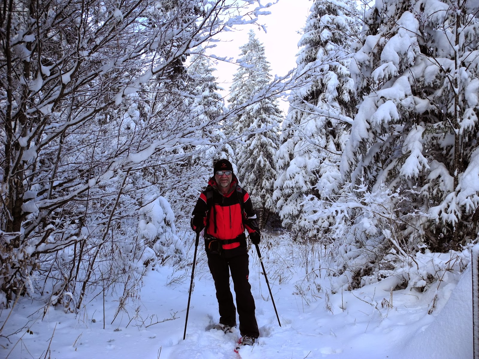
Ideal snowshoeing conditions on the trail.

Looking back up the mountain as the sun threatens to break through the clouds.

Gorgeous snow-covered trees in the Bois de Croisettes.

Not surprisingly, it didn't take us long to get back down to the Chalet du Mollendruz which was sufficiently below the cloud layer that the afternoon sun was able to cast our long shadows across the landscape. It was only about 3pm, but being winter, the sun was already very low in the sky. We stopped for awhile on the slopes above the chalet and watched kids tobogganing, and took-in the views of the distant Alps - out across the Swiss Plateau.

Arriving back at the Chalet du Mollendruz.

The Alps were mostly obscured by the scudding cloud layer, but from time to time we caught a glimpse of the Dent du Midi or other distinctive peaks on the eastern horizon.

Occasional glimpses of the Alps through the scudding clouds.

Les Alps.

Enticed by the opportunity to drive home in the warmth of the last of the day's sunshine, we soon made tracks down past the chalet, and then on to the Col du Mollendruz.
Heading back down to the Col du Mollendruz.

We got back to the car-park at about 3:15pm, where we dropped our snowshoes and tucked into some fruit-and-nuts and the last of our our water - still luke-warm inside our trusty thermoses. It had been a good day, and another great Jura walk.

Jura peaks bagged:
  • Haut du Mollendruz (No. 65) 1441m

Trivia
  • According to Peakery.com, the Haut du Mollendruz is ranked as the 6,228th highest mountain in Switzerland. 

Saturday, October 19, 2013

Crêt de Chalam (No 29)


A Sunday "stroll" to the top of Crêt de Chalam turned-out to be anything but ... however it also turned-out to be one of the most adventurous treks we have done in all of the 50 Jura peaks that we've now climbed during our Jura Mountain rambles. As you can see from the photo above, it was a wild, wet and wintery day (not what you'd expect in mid-October, mid-Autumn). It was more like the weather we encountered at the summit of Ben Nevis (Great Britain's highest peak) where we were just a couple of weeks earlier.

Standing in the Scottish mist atop Ben Nevis - 1343m. (28/9/2013)

But the hike to the top of Crêt de Chalam - which, at 1545m is about 200 metres higher than Ben Nevis (but a "lowly" 29th highest peak in the Jura Mountains and 2,015th highest in France) - wasn't meant to be like that. The forecast for the day was "fine". And it certainly started-out that way when we woke-up at our home in St George - about an hour away (by car) to the north. Although we'd experienced an unseasonal (very early) couple of snowfalls during the week, the skies were clear and the gorgeous, warm, early-morning light over the village sure made the prospect of a day's hike in the mountains all the more enticing. Not to mention the prospect of tromping through a first blanket of snow at the top of the Jura - on one of the last of the peaks in the "top 30" that we hadn't climbed.

 Beautiful, warm autumn colours in the early morning sunlight over St George.

 Knowing that these kinds of days often get better as the day warms up, we took our time organizing our packs and gear, and slowly drove south to our kick-off point at Chézery-Forens - a tiny village across the French border in the synclinal Valley of the Valserine. Chézery was founded in about 1140 - when an ancient order of monks settled there and built an abbey. It stayed an "abbey town" until 1793 - when angry locals (who'd been tied as serfs to the Royal Abbey of Chézery for the centuries in the interim - rose up and rebelled against their rulers to win freedom. Over the years it has been known for its sequence of industries which have included farming, forestry, asphalt production, and watch- and cheese-making.

Thanks to the mid-week snowfalls, there was a good blanket of snow all over the Jura, which was pretty to watch, but tricky to manouvre at times - especially on the occasional patch of black ice that we encountered on some of the more shaded and frozen sections of the road that ran along the west side of the main Jura ridge. Fortunately we arrived in Chézery incident-free, at about 10:30am, when we parked our trusty Subaru in the carpark alongside the main road, just below the church. Although shaded on our side, the main Jura ridgeline was cloud-free, and we had great views to the east and northeast. Dominating the scene were the precipitous snow-capped cliffs of Roche Franche (1692m, No 4), which, along with Crêt de la Grotte (La Marie de la Jura" - 1644m, No 9), we'd climbed in mid-2012. Further south we could make-out Les Avalanches (1497, No 44) and Pierre de la Lune (1510, No 43) which were still on our "yet-to-be-climbed" list of the 50 highest.

Looking back up the main street of Chézery-Forens (580m), with its great views of the magnificent, craggy Roche Franche amphitheatre

 Crossing the Valserine River, and feeling encouraged by the patch of sunlight hitting the eastern side of the second Jura ridgeline - our hiking destination.

We left town at about 10:45, and headed southwest down the road to Forens, the first waypoint on our route - about 15 minutes along the route. There, we crossed over the Ruisseau de Forens (river) and immediately turned right to begin our climb up the mountain. Initially the path followed an old road (which soon turned into a two-wheeled track) that ran alongside the bubbling stream. The Ruisseau de Forens was beautiful to walk alongside, as it frequently cut through steep, narrow gorges and tumbled over waterfalls and cascades - filling the air with that unique sound that only crashing, tumbling mountain streams can make. It was a beautiful tumult to have in our ears at the start of a long uphill hike.

Adding to the splendour were the millions of autumn leaves that littered the forest floor around us and created a golden-brown carpet on the trail under our feet. We were feeling happy, and optimistic. This day was just getting better and better. Sure, up ahead we got occasional glimpses of the mountain-top shrouded in cloud, but (being ever optimistic) I figured this would all clear perfectly for us by the time we got to the summit in a couple of hours.

Gorgeous autumn leaves on the track near Forens.

Heading up the trail alongside the Ruisseau de Forens.

Crossing over the bubbling Ruisseau de Forens just near les Cascades des Etrés.

By now the sunshine had well and truly disappeared, and we were in the shaded depths of the deciduous forest - somewhere between the Montagne des Moines ridgeline to our east, and the summit of Haute Crête (1431m, No 69) to the west. We passed by the (already abandoned for winter) Petit Mannet farmhouse and plunged deeper into the forest along a thin and sinuous forest trail that snaked its way up the mountainside.

We soon reached the ruins of Grand Mannet (970m), where we stopped just long enough for a drink of water, and to take a few photos. I'm not sure how many years ago Grand Mannet was abandoned, but the forest sure has been winning the battle of the wills ever since. There were a multitude of trees growing inside the once extensive building, their roots upsetting the foundations, while others had fallen across the walls, knocking-down many sections. Nature reclaiming its turf.

The Grand Mannet ruins.

The trail soon became confined to a thin ribbon of ground on the ridgeline of a long spur that would eventually lead all the way up to the top of the mountain. Down below us, off to our right, was the valley of the Combe du Nant Sec, while on the other side the terrain just-as-steeply dropped away to the Combe de Ramas. Somewhere along this section we passed by the Nant Sec Rnes, then the Crête Rnes (as they were marked on our topographic map), but we didn't stop to investigate, being more intent on pushing-on, enjoying the magnificent trail and getting to the summit. The forest was simply beautiful - filled with fallen leaves, intense green mosses and delightful fungi of all shapes and sizes. At around 1100 metres we started to encounter our first patches of snow ... and things began to get more and more interesting and exciting.

The trail near la Crête Rnes, with the first patches of snow indicating we were certainly in for a healthy layer of snow on the mountain-top ahead.

We soon found ourselves up among the clouds, with visibility diminishing with every metre in altitude. The trail became increasingly harder: Harder to see, harder (steeper) to climb, and more and more slippery. Wet slippery rocks, wet slippery mud, wet slippery leaf-litter and slippery snow. Sometimes you'd put your foot down on a patch of snow, that covered a sodden layer of leaves, that covered a wet and muddy rock. Needless to say, it wasn't easy going and we slipped and slid over the rocks in some of the trickier phases. I took a couple of spectacular tumbles into the snow or sludge, but fortunately came to no real harm. With the trail increasingly confined to the ridgetop - a long arête that just went up and up for about two kilometres - our mood became more and more serious. Our conversations dried-up - and we focussed our attention on staying upright and intact.

Heading into the white-out approaching the top of Crêt de Chalam.

I think I'll let the following sequence of photos speak for themselves. They were all taken in the final push to the top of the mountain. The visibility dropped with every metre of altitude, along with the temperature, while the wind-speed rapidly increased.


After successfully negotiating the final steep, slippery staircase of mud-and-snow covered wooden logs, we reached the summit of Crêt de Chalam (1545 metres) at about 2pm. We quickly dropped our packs and pulled-out every item of clothing we had in there: fleece, windbreaker, another windbreaker, scarf, beanie and fresh (dry) pair of gloves ... and pulled all of it on. We were instantly warmed, but it still felt like we'd arrived at the North Pole! The famous views (beautifully interpreted on the panorama panels there) were nowhere to be seen, and a howling blizzard threatened to blow us off the mountain-top. Needless to say, we didn't stay at the summit for very long, the wind tumult and its arsenal of snow pellets led to a rapidly diminishing comfort level, so we stayed just long enough to have a wander around, to take a few photos to capture the occasion ... and then we skedaddled.

Looking east where we should have got fantastic views of the highest Jura ridgeline (with the Crêt de la Neige and le Reculet peaks somewhere out there), and beyond that Mont Blanc and the Alps

Standing on the edge of the world. It must be out there somewhere.

The second observation table looking west out over the French Jura. Rien!

 Flying the flag at the cairn on top of Crêt de Chalam.

"Racing" downhill, it didn't take us long to clear the summit, and drop-out of the alpine blizzard zone, and we were soon back to the Sous le Crêt (1490m) trail marker, which we had passed on the way up, not far from the summit. Here we turned north (instead of south which would have retraced our outward route), and headed towards the Borne au Lion.

The trail marker at Sous le Crêt.

The trail was steeply downhill for the first bit, at times in snow 30 centimetres deep, then it began to flatten-out and follow a gouged and grubby two-wheeled forest track. This provided us with some tricky sections, not to mention (alternating) wet and muddy boots. These were soon cleaned again whenever we had to cut through a "good" section of fresh snow.

Negotiating one of the slippery slopes just southwest of Crêt de Chalam.

 There was lots of mud and snow and slush and ice on the forest trail between Crêt de Chalam and the Borne au Lion.

Eventually we dropped-down below the cloud layer again, and reached a T-intersection with a forest road that ran east-west. The sign indicated that we were just five minutes or so away from the Borne au Lion. Needless to say, we turned right, and soon found ourselves at the historic landmark (1289m).

 The GR9 trail marker near Borne au Lion.

There is a fabulous shelter there (although not very sheltered on this occasion with the wind and rain blasting through horizontally). But it had great picnic tables ... so we pulled-up a (very wet) seat and broke-out our standard Jura lunch of bread, cheese, fruit-and-nuts, hot tea ... and a shot of Marc from my hip-flask. It was by now about 3pm. Bliss. 

 The shelter and interpretation centre at Borne au Lion. Day-trippers can drive all the way up to here from La Presse.

After a short lunch stop, we had a wander around the site - checking out the various interpretation panels, monuments and, of course the famous limestone plinth called the Borne au Lion (although there were a couple of these around). Strategically located on a historic communications axis, the Borne au Lion (which was once called the "Terminal of Three Empires") means the "Terminal of the Lion". It marked an ancient border between the three former kingdoms of France, Savoy and Franche-Comté (the latter being a dependency of the Spanish crown at the time).

The Borne au Lion dates back to 1613 when it was erected to commemorate the signing of the Treaty of Auxonne (in 1612) which established the County of Burgundy. Although now mostly eroded away, the four faces of the stone were engraved with the symbols of the three empires: the cross of the Duchy of Savoy, the lion of Franche-Comté and the three lillies of France. Apparently, other terminals had been set-up here by Henry IV in 1601 to commemorate the defeat of the Savoy and the proclamation of the Treaty of Savoy; and the return of the Spanish lands to France under the Treaty of Lyon. One interesting condition of this treaty was to allow the Spanish to retain an access route through the region (along the Valserine Valley) to allow them free passage from Genoa (in Italy) to the Netherlands. This ancient route was known as "The Way of the Spaniards"

Checking-out the Borne au lion. You can just make-out one of the faded symbols.

There were also ta number of sombre plaques and installations commemorating the significance of this site to the French resistance during the Second World War. This heavily forested, rugged and dangerous part of the Jura was a hotbed for the Maquis during the period of German occupation in WW2. Apparently about 3,000 resistance fighters, under the command of their legendary leader Romans-Petit, used this area as a base around 1943-44.

 An installation and plaque at Borne au Lion honouring the Maquis de l'Ain et du Haut Jura freedom fighters of the mid-1940s.

 We had one last look around, looked-up towards where the summit of Crêt de Chalam should have been towering above us, and then started our return journey back down the mountain.

This is what the view should have looked like - the imposing cretaceous Crêt de Chalam.

 This is what we could see.

At first the "Tour de la Crêt de Chalam" route followed a road to the nearby les Magras farmhouse, where we passed the ancient, disused Moulin de Magas flourmill and entered the deep forest again. From there, we followed a narrow, leafy trail all the way downhill, alongside a creek that started somewhere uphill beyond the mill and tumbled down the valley before eventually emptying into the Valserine River about two kilometres to the east. Gradually the snow disappeared from the trail, the leaves got thicker and the terrain less-steep. It was all down-hill from here.

The lovely trail back down the mountain, near the old Moulin de Magras.

Gotta love those autumn leaves.

With the craggy top of Creux Manant (1035m) on our left and the (hidden) summit of Mont Plat (1335m) on our right, we revelled in the long, easy traverse that headed first southeast, then south along the Valserine valley. We exited the forest and, one-by-one, passed the Chateau des Bois, Combet and Noire Combe landmarks. Once again the main Jura ridgeline came into view, although much of it was also now obscured by clouds. Occasionally the sun would break through and light-up a magnificent section of the mountain-top. We'd stop every time and take photos.

Looking back at the snow-covered cliffs and peaks of Roche Franche.

 Roche Franche in all its glory - a deeply-incised mountainside gouged-out by Quaternary glaciers and thousands of years of subsequent erosion.

Despite missing a turn just after Noire Combe (which meant we inadvertently followed a parallel track), we eventually arrived back at Chézery-Forens. It was about 5pm - just over six hours since we'd left earlier in the day. 

It had been another great walk (about 14 kilometres), made all the more memorable by the wild conditions we experienced at the summit. Shame about missing the magnificent views. It just means that we'll just have to go back there again - on a fine, sunny day sometime in the future.

Jura peaks bagged:
  • Crêt de Chalam (No 29) 1545m