Le Suchet may be number 19 on the list of the Jura's highest named peaks, but it provided one of the year's most amazing hikes, and views of the Alps. It also marked our 40th Jura peak for 2012.
There are a number of places from where one can commence a hike to the top of Le Suchet - Ste-Croix, Ballaigues and Baulmes among them, but we chose the popular set-off point of Entre le Fourgs (1074m) - which is in France (but right on the border), and about five kilometres west-southwest of Le Suchet (as the crow flies).

The tiny village of Entre les Fourgs - 1074m.
We arrived there at about 10am on Christmas eve - for our last Jura summit for 2012 - and parked the car in the car park just beyond the old church in the middle of the town. Although a tiny place, Entre les Fourgs can get quite busy in winter, thanks to a ski lift and ski run right above the town. We tromped across the snow to a yurt - yes, a yurt (not something you expect to see every day in Switzerland), where we sat down and strapped-on our snow shoes.

Lis outside the yurt near Entre les Fourgs.
We were soon on our way, heading southeast straight up the hillside called "Côte Marguiron", just on the eastern flank of the smaller of the town's two téléskis. On our left was the valley of la Jougnena Rau, which provided a great view of Les Aiguilles de Baulmes - number 24 on my list, and yet to be climbed.

Les Aiguilles des Baulmes - 1559m.
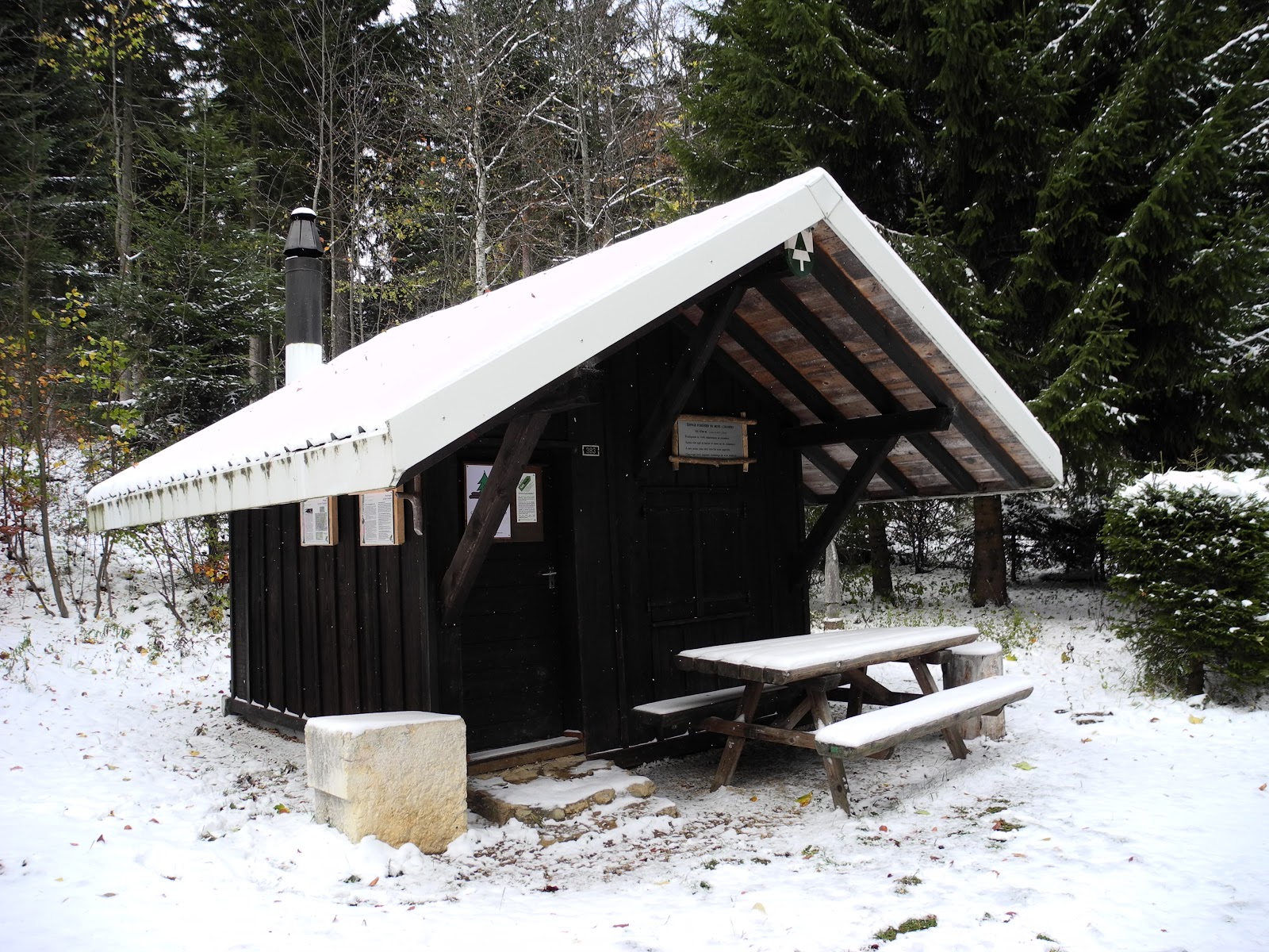
We wound our way into the forest, away from "the bustling crowd" and began enjoying the tranquillity that comes from snow-shoeing across beautiful fluffy snow high in the mountains. We passed a small cabin, where we stopped for an obligatory "trail marker" photograph, then headed further-on, up the hillside, rapidly gaining altitude with each step up the steep slope.

Lis at the little log cabin on the trail just above Entre les Fourgs.
The next landmark on the trail was the la Piagrette Chalet farmhouse - now completely snowed-in, shuttered-up and abandoned for winter.

la Piagrette Chalet.
From there we headed due south for a couple of hundred metres - where we encountered an old stone wall that also happens to mark the France-Switzerland border. There are a number of stone markers along the border, and we crossed back into Switzerland just to the west of one of them.

This one had "42" chiselled on one side, and "1824" on the other.
Further down the fence-line is a gateway (which we encountered on our way back later in the day) which has an official border-crossing notice reminding us to have our passport on hand and to declare all goods to the customs officials. We didn't anticipate encountering too many customs and immigration officials in the snow, on a remote mountain trail in winter, on Christmas eve. We had the entire mountainside just about all to ourselves.

The border customs and immigration sign near La Piagrette Chalet.
We turned due east after passing over the border, now finding ourselves on the main Chemin des Crêtes du Jura mountain trail, and headed up the slope to a small cabin called Petit Bel Coster (1277m). Just near the cottage we crested the top of the ridgeline, which gave us our first views over the main Jura ridge towards the Alps. Despite a bit of haze, Mont Blanc was clearly visible, as indeed were all of the Alps across Lac Léman - all the way along to the Dents du Midi.

Mont Blanc on the horizon above Lac Léman.
The views towards the Alps continued to open-up as we continued on our way, and gained height, up the ridgeline northwest of Petit Bel Coster. Looking back, we also had great views along the peaks of the southern Jura - of Mont d'Or, Dent du Vaulion, Mont Tendre and even La Dole in the far distance. It was classic Jura landscape and scenery.

Looking back towards Mont d'Or - which we'd climbed in October.
We were constantly stopping to take-in the magnificent views. We'd been blessed with a gorgeous day, perfect for snow-shoeing in the mountains. So far we'd had a mix of sunshine and cloud, comfortable temperatures, and no wind. Just about perfect. The snow conditions were much the same. Ideal.

Lis taking-in the beautiful views from the ridgeline near Bel Coster.
We soon reached a place called Grand Bel Coster (1392m) - a summer cattle barn - which was now abandoned, and unreachable, with a huge bank of snow blocking the entrance to its open barn doors. Once again, we stopped just long enough to take a landmark photograph (of the barn), and some more of Mont Blanc and the Alps, then headed on our way. For the first time, up ahead, we could see our final destination - the summit of Le Suchet. We still had a couple of kilometres of snow-shoeing ahead of us, and about 200 metres to ascend.

Heading east of Grand Bel Coster with the twin peaks of Le Suchet in the background.
The trail zig-zagged downhill (groan ... 'cos it meant that we'd have to gain all of that altitude again, which is never much fun), towards a place called La Poyette. Before we got there, we encountered a section of the Toblerone Line (I wrote about it in the blog from Dent de Vaulion - No 49; and see "Trivia" below).

A section of the Toblerone anti-tank line near La Poyette.
We stopped to take photos and to check-out the topographic map, which I promptly mis-read (thinking that the road sign "La Poyette" that we were standing alongside was the actual place - which was in fact about half a kilometre to our northwest, hidden behind a small hill). So we left the trail and plunged into the forest, making our own trail across fallen logs, snowdrifts, smothered rock walls and the like to the hilltop ... from where we caught sight of the real La Poyette.

La Poyette Chalet, more of the Toblerone Line, and (in the background) Le Suchet.
We skidded our way down the slope to the homestead (also abandoned now for the winter), where we wandered around, took some more photos, and steeled ourselves for the last "schlep" up the hillside to the mountaintop.

The trail sign at La Poyette - 1331m.
One of the more amusing sights at La Poyette was the family car, which for some reason had been left parked behind the house before the onset of winter, and accompanying snowfalls.

He ain't going nowhere.

Lis alongside the Toblerone Line at La Poyette.
From La Poyette it was all straight uphill to the top. The trail cut through a patch of forest just above the chalet, following first the Toblerone line of concrete blocks, then railway-line spikes driven into the ground, followed by a stone wall and wire fence-line. It would have been hard to get lost now. Once out of the forest, with the sun breaking through again, the views became better than ever. We stopped every hundred metres or so, to catch our breath, and to take-in the magnificent views of the Alps and lakes to the east.

Lis approaching the summit of Le Suchet.
Le Suchet - which means "rocky point" or a rounded hill-top - has two summits, one (at 1554 metres) marked with a cross, and another (at 1588 metres) with a prominent geodetic survey trig station. There was very little snow at the top, or vegetation (it's treeless), which is not surprising really - given the winds that scream over the Jura at this altitude. Most of the Jura's highest summits are bare and wind-blasted. Le Suchet is no exception, covered in little more than stunted sub-alpine vegetation. The wind must have been blowing at about 50 kilometres per hour at least. I read one hiker's account where he thought the wind had been about 100kph. Needless to say, he said he didn't stay long at the top. (Not surprisingly, the ridgeline here is very popular with paragliders in the balmier, calmer, summer months.)

At the southwest (lower) summit of Le Suchet.
We stopped just long enough for a couple of commemorative pics, and then hastily dragged on our Mammut wind-stopper jackets, beanies and heavier-duty gloves. Then we dashed down into the hollow between the summits to try to find a sheltered place to have lunch. It was now about 1.45pm, three and a half hours after we'd set-out from Entre les Fourgs. We hunkered down behind a rocky outcrop on the western side of the summit, with views out over the Jura ridges that gradually diminished into the distance into France.

The rocky outcrop (at left) where we hunkered down for lunch. The summit of Le Suchet in the background.

Another view of Le Suchet summit and our lunchtime picnic spot.
Lis remarked on the irony of us having one of the best views in the world just on the other side of the outcrop - where we would have been blasted into hypothermia if we'd been stupid enough to sit there. Hypothermia isn't fun, so we crushed together and ate our cheese sandwiches, and drank our two big thermoses of hot tea. Heavenly, but freezing. So we ate our lunch in record time, and then headed towards the summit. We knew we were heading in the right direction when we came across this trail sign ... mostly buried.

The famous Jura Crest Trail is down there somewhere.
First we had to go downhill again - into a saddle at about 1505 metres - between the two peaks. Amazingly there was almost no wind there. Well "almost" in a relative sense. It was still very strong. We stopped while I took a few photos, and shot a short video, to capture the beauty of the view towards the Alps in the distant east.

The magical arc of the Alps - from north to south.
From the col, it was a short slog up-hill to the second, higher summit. Recharged from her thermos of hot tea, and conscious of the passing time (we had to get back to the car by dark, on one of the shortest days of the year), Lis led the way. The snow was now increasingly icy, and slippery, making the last few metres particularly hazardous. The slopes on the northwest and southwest side drop steeply, vertically in some places, about 800 metres down onto the plain. Needless to say, we trod carefully.

Lis on the last section of the trail to the summit of Le Suchet.
We were soon standing at the scoured summit, once again being blasted by the terrific winds. I pulled my well-travelled Swiss flag from out of my back-pack, and Lis snapped off a few celebratory photos ... then bolted back down the mountain.
The views were amazing, and I was determined to enjoy them for as long as I could - despite the bitterly cold wind. To the north lay the Baumine valley, and beyond it the marvellous massif and summit of Le Chasseron. To the west was the Jougnena valley and the diminishing Jura ridgelines. To the east ... it was all magic ... lakes (Neuchâtel and Leman), plains and Alps.

Under the geodetic triangulation survey pyramid at the summit of Le Suchet - 1588m.
I stayed for a short while to take a few photos, and to shoot some more video ... which later turned out to be so wind-shaken and tormented to be virtually unusable - then headed down in cold pursuit. It was now about 2.30pm.
The wind had been incredible at the summit, reminiscent of the "tempest" which the famous early 19th century English poet Percy Bysshe Shelley wrote about in his poem "On the dark height of Jura":
"Ghosts of the dead! Have I not heard your yelling
Rise on the night-rolling breath of the blast,
When o'er the dark aether the tempest is swelling,
And on eddying whirlwind the thunder-peal passed?
For oft have I stood on the dark height of Jura,
Which frowns on the valley which opens beneath;
Oft have I braved the chill night-tempest's fury,
Whilst around me, I thought, echoed murmurs of death.
And now, whilst the winds of the mountain are howling,
O father! thy voice seems to strike on mine ear;
In air whilst the tide of the night-storm is rolling,
It breaks on the pause of the elements' jar.
On the wings of the whirlwind which roars o'er the mountain
Perhaps rides the ghost of my sire who is dead:
On the mist of the tempest which hangs o'er the fountain,
Whilst a wreath of dark vapour encircles his head."

Looking northwest along the Jura towards Le Chasseron (No 14).

The majestic view in the east - the Alps.

Looking down on Lake Neuchâtel and the lake-side village of Yverdon-les-Bains.
I soon caught-up with Lis, who was waiting in the sheltered col. We slowly made our way back to the second summit, taking a few more photos along the way. We also surprised a small mob of chamois feeding on the exposed grasses and herbs. Being downwind, we were able to get quite close to them. In all, we saw about half-a-dozen chamois during the walk.

Lis looking happy out of the wind.

A semi-buried Chalet du Suchet, with Yverdon-les-Bains and Lac Neuchâtel in the distance. It's possible to drive to the 17th century Chalet du Suchet (1489m) during the warmer months. It provides meals and a place to stay for transjurassien ramblers and other hikers.
Before long, we were back at the lower summit, where we paused for one last, long look at the amazing view over the Swiss Plateau towards the Alps, and back up towards Le Suchet.

Lis looking east towards the Alps from the lower Le Suchet summit.

Last look back to the summit of Le Suchet.
We were now enjoying beautiful sunshine, beautiful powder snow ... and no wind. It was truly glorious. We made good time back down the ridgeline to La Poyette. This time we kept to the trail, skirting around the northern side of the hillock we'd "bush-bashed" over on the way up.

Lis on the trail west of La Poyette. Le Suchet in the background.
The sun was shining bright, but sinking fast in the (south) western skies. A huge bank of black cloud was building-up over the southern Jura, which would mean the sun would set even earlier than normal today, so we kept our heads down and made tracks as fast as we could. We trekked back up the ridgeline to Grand Bel Coster, then back down the other side towards Entre Les Fourgs.

Lis passing Grand Bel Coster.
Sure enough, once the sun hit the wall of cloud over the Jura, the lights went out very suddenly, and we found ourselves making our way down the last bit of the mountain in growing darkness. Even so, it added something special to our hike, and the sight looking back over Entre les Fourgs, once we reached there, was magic.

The French Jura to the west of Entre les Fourgs (in foreground).
We trudged down the last of the slopes, past the ski run now filled with twilight skiers, and back into Entre les Fourgs. It was about 4.45 - six and a half hours since our departure from here this morning. Six hours on the trail in snowshoes! We'd feel it in the morning, but we'll also look back on one of the best hikes we've done all year. I can definitely recommend Le Suchet as a destination for anyone wanting a great hike in the Jura.
Jura Peaks bagged
- Le Suchet (No. 19) 1588m
Trivia:
- Schlep: To go somewhere far away, usually a difficult destination that takes some toil to reach.
- The Toblerone Line's real name is the Promenthouse Line, named after one of the three rivers along whose course the toblerones run (the others being the Combe and the Sérine). It is an anti-tank line, first built in the 1930s, but reinforced during WW2. In total length about 15 kilometres, the line of 16 tonne, triangular-shaped concrete blocks is more commonly now called the Toblerone Line - in recognition of the similarly-shaped popular Swiss chocolates (which are apparently themselves modelled on the shape of the Matterhorn mountain).
- Percy Shelley wrote "On a dark height of Jura" as part of an epic entitled "St Irvyne; or, The Rosicrucian" - which he wrote while at Eton College in about 1810. He visited the Jura twice in the following decade. (See also Le Noirmont).